Poor Visibility
12th March 2024
Poor visibility hampered observations today on Ben Nevis. Snow at higher elevations transitioned to rain. This has produced a noticeable thin rain crust in some locations above 900 metres. This event may also have contributed to the debris that was observed at the bottom of No.5 Gully. Although there was debris in this location previously, there appears to be overlapping sets suggesting a more recent cornice collapse.
Tomorrow will be a distinctly problematic day in the mountains with storm force winds for the duration. Overnight rising temperatures will result in a thaw at all levels. Cornice collapse is anticipated and where new deposits of snow exist from recent days these will rapidly become saturated. As such a period of instability is anticipated, with wet loose or wet slab avalanches running out to easier angled slopes.
The good news is that this instability is expected overnight, before the temperature drops around dawn. This will hopefully negate the most hazardous part of the forecast, and anybody braving the storm force winds tomorrow should see a more stable picture.
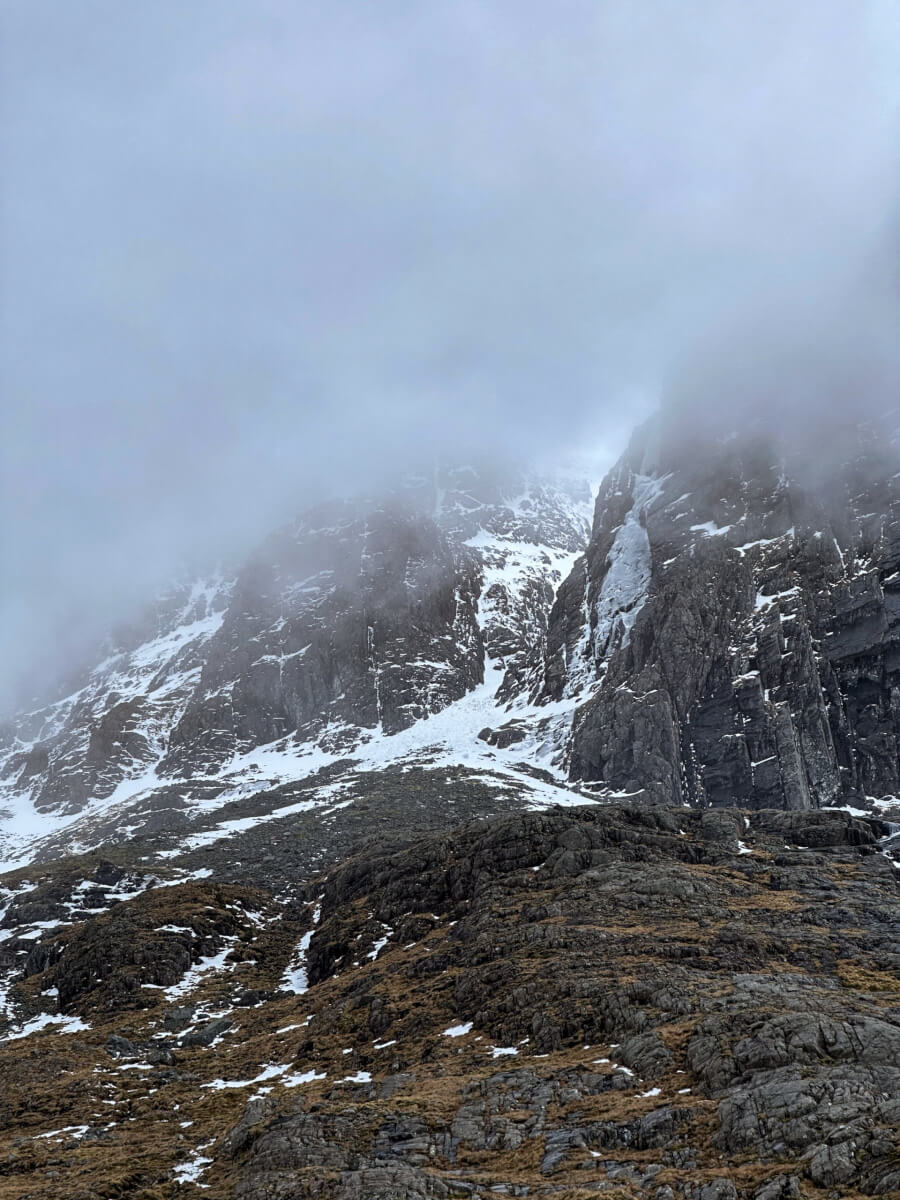
No.5 Gully with some avalanche debris visible on the crag apron and in the narrows.
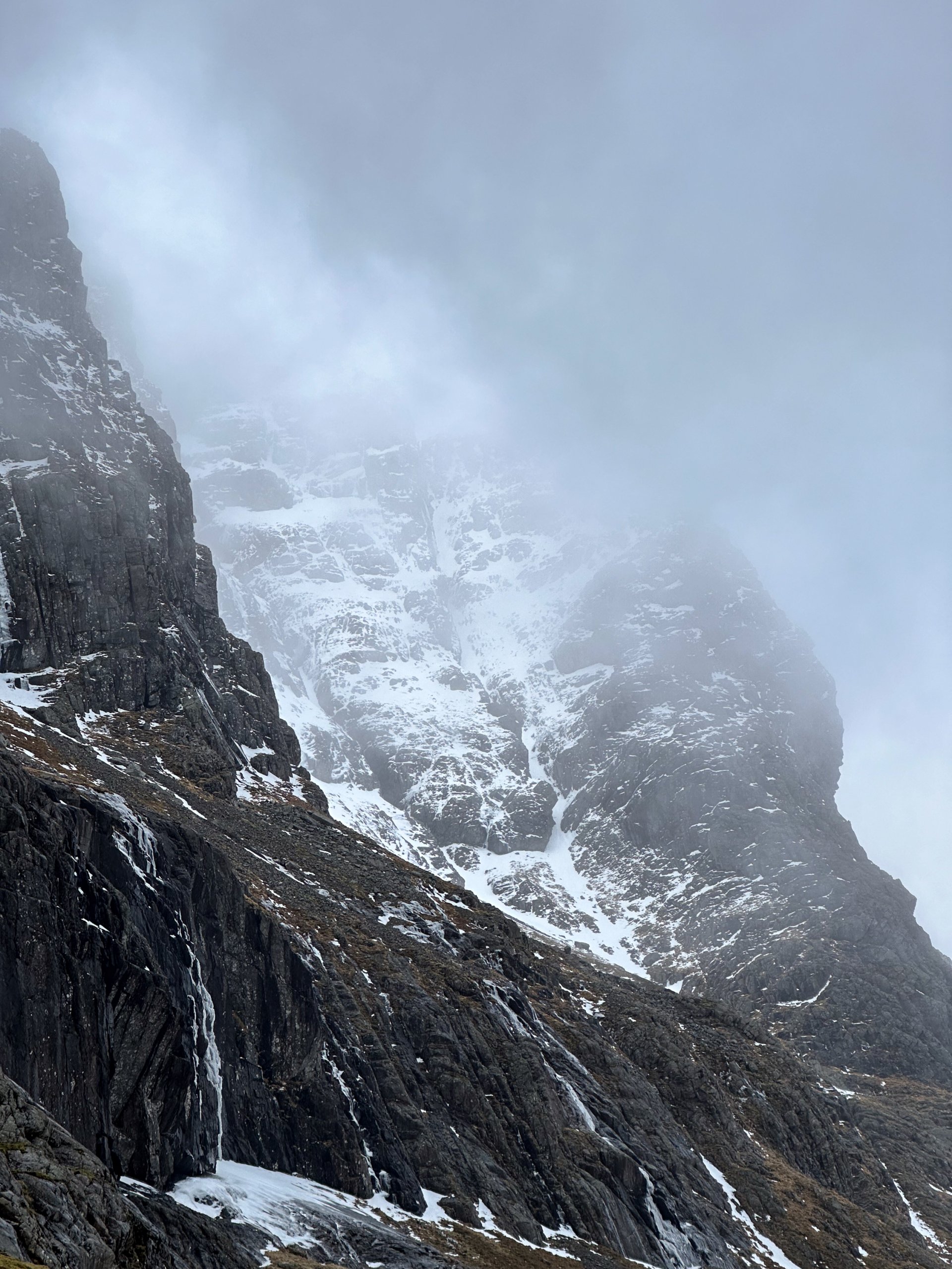
Looking into South and North Castle Gullies. The CIC hut cascades appearing to hold some transient delaminating strips of ice.
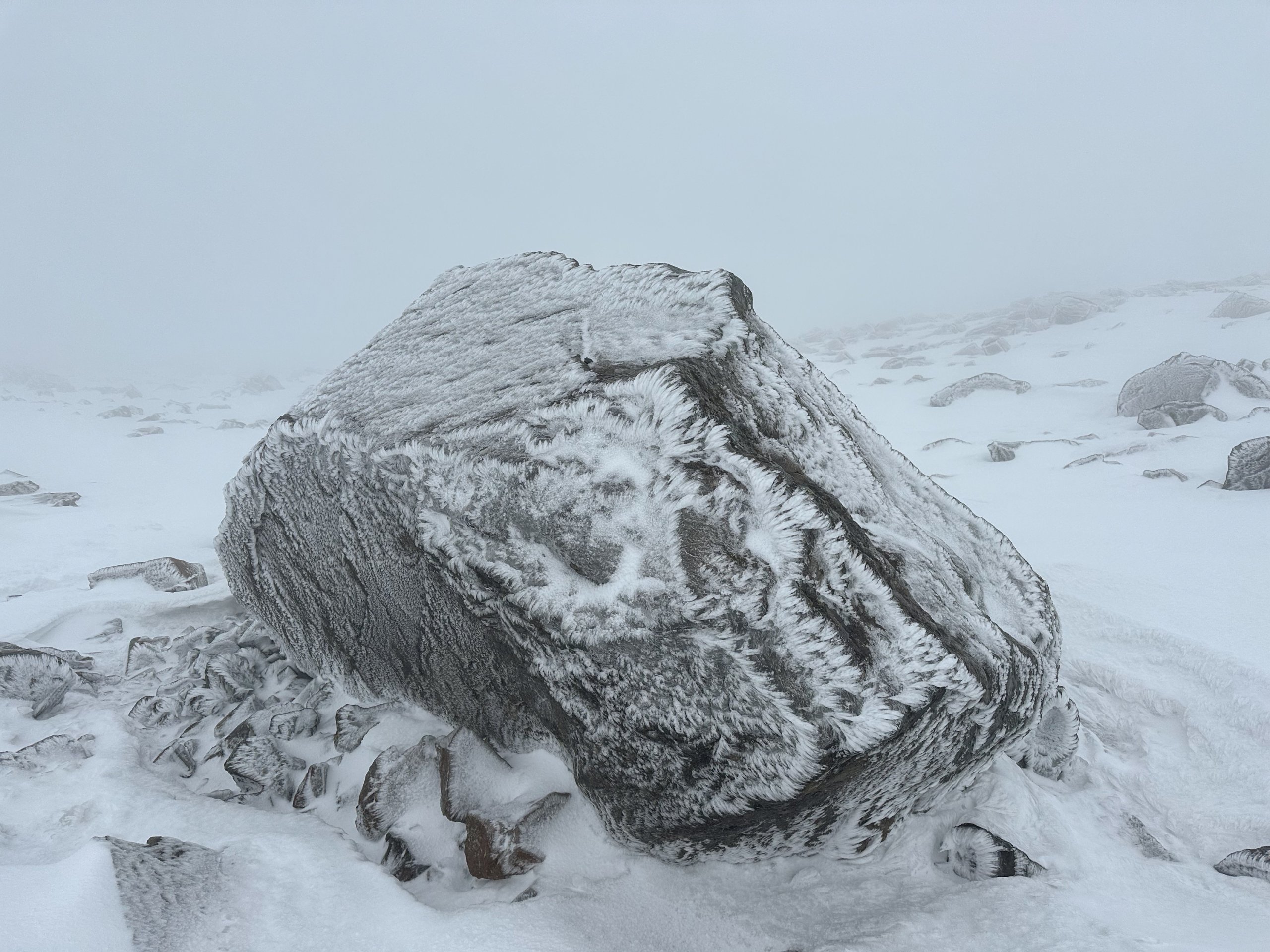
This large boulder in Coire Leis showing some rime ice. The windward side was also plated in ice, potentially due to the presence of freezing rain at around 900 metres last night.
Comments on this post
Got something to say? Leave a comment