Another Rainy Day
20th February 2024
It was another mild and damp day with rain through the morning. It did try to for a period around the middle of the day, but there were some heavy showers during the afternoon. After a mild morning with the freezing level well above the tops, it became slightly colder in the afternoon with the freezing level dropping to around the level of the higher summits. It is now about a week now since the summit temperature have been significantly below freezing. Although no unprecedented, it is not that usual to have such long periods with the freezing level 1100 metres or higher at this time of year.
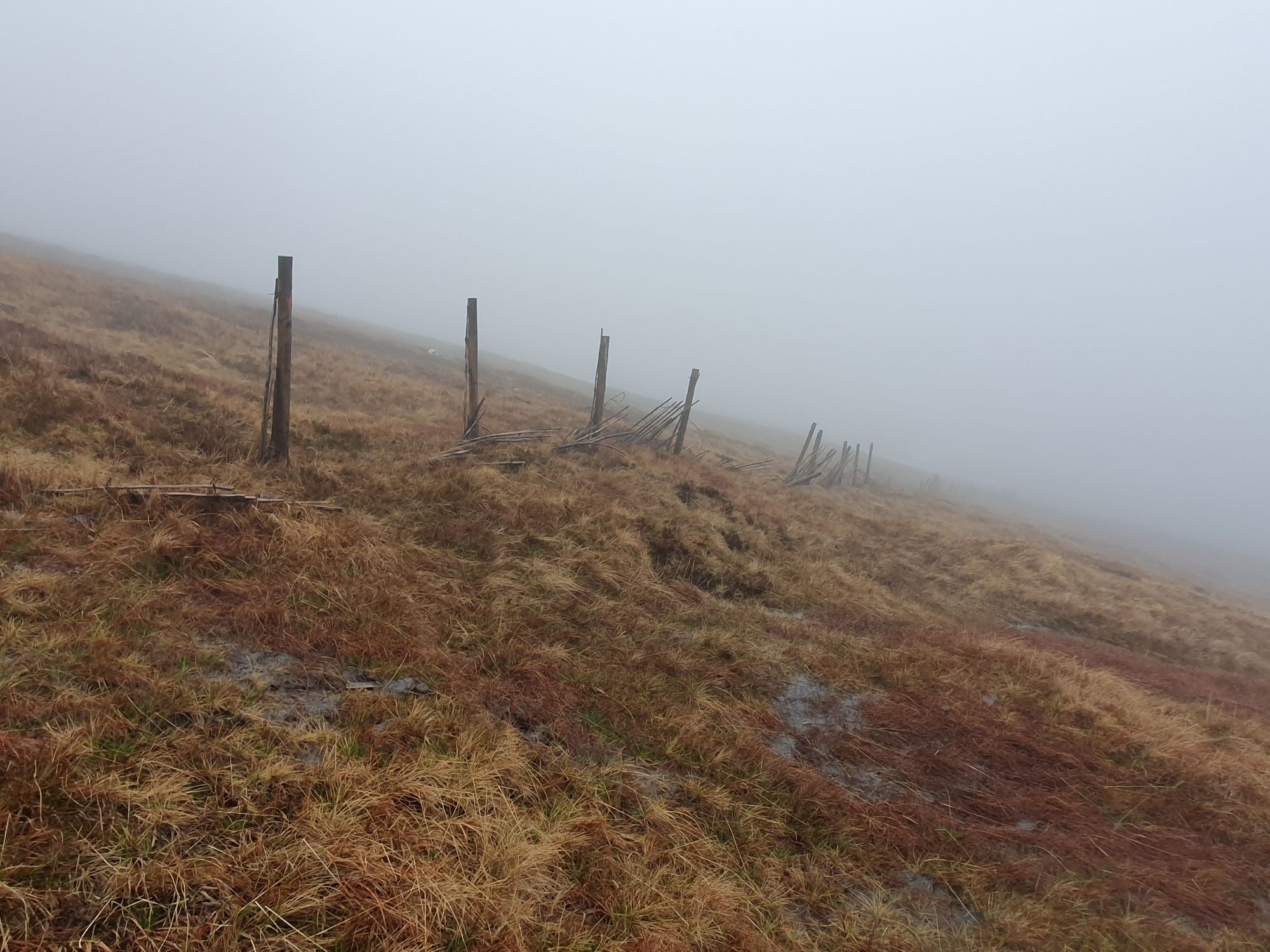
A misty, murky, mild, moody morning.
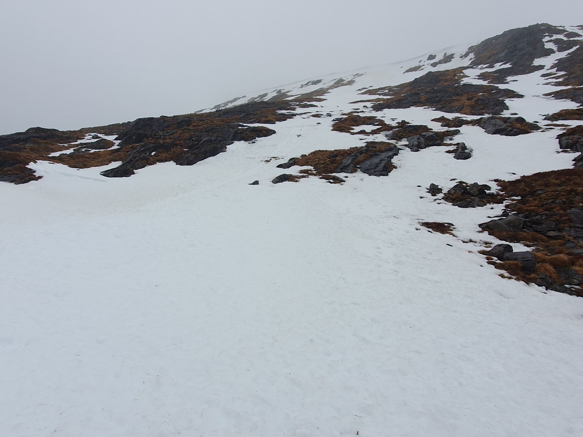
Looking up the Cairn Slope when visibility cleared slightly.
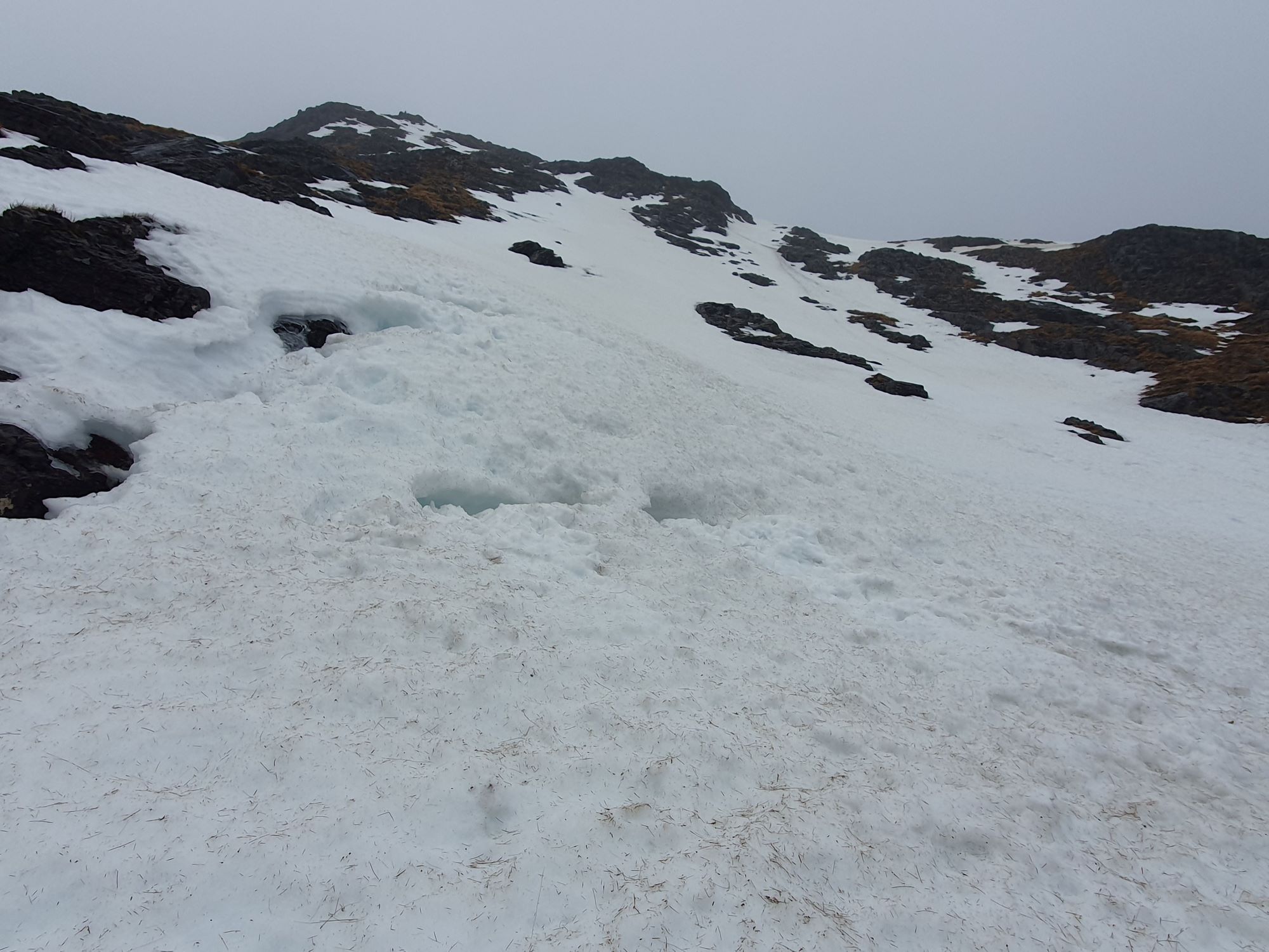
Old, well consolidated snow in G and T gully. An old crown wall can be seen running diagonal across the top of the gully.
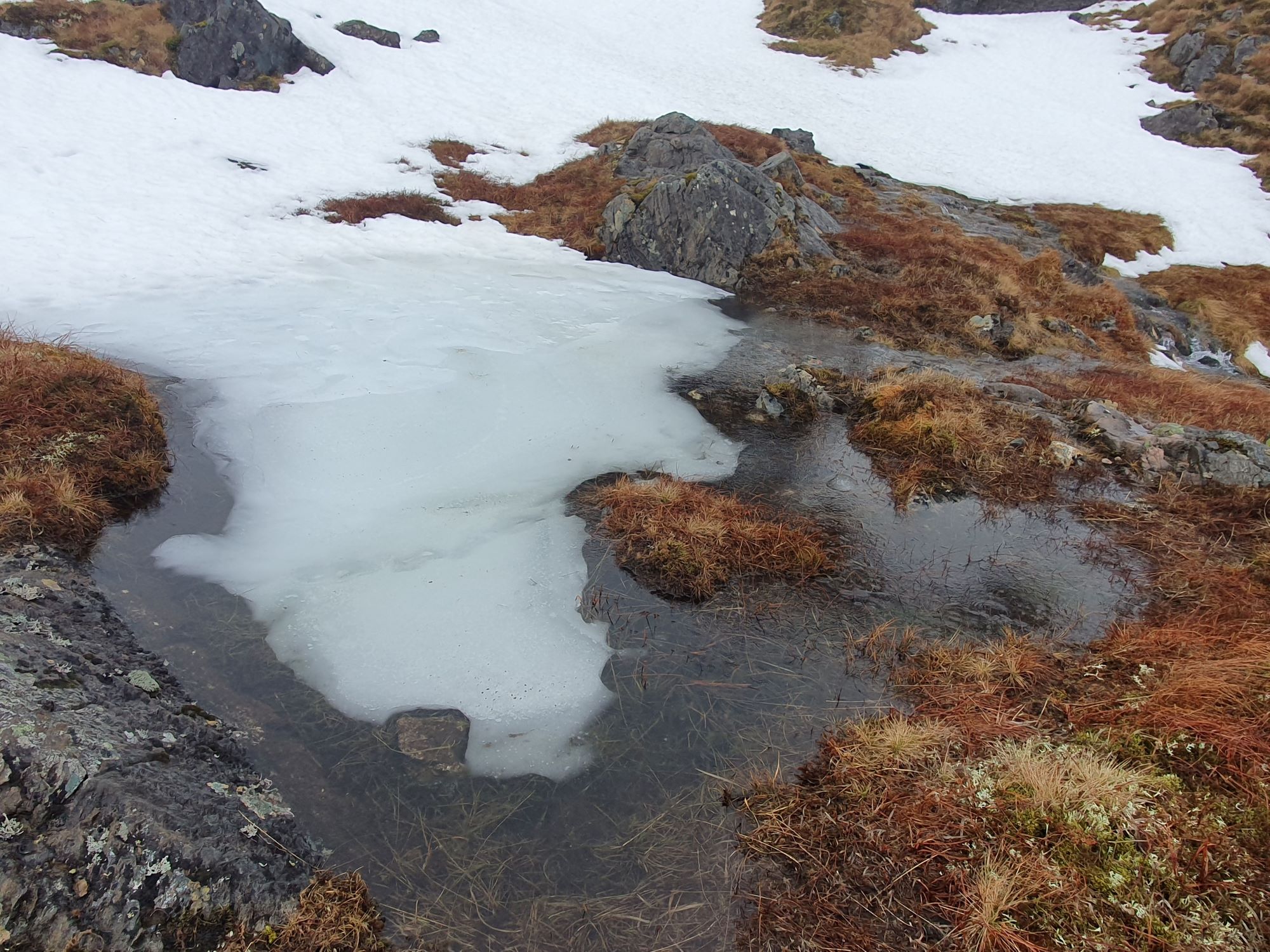
Thawing and Wet.
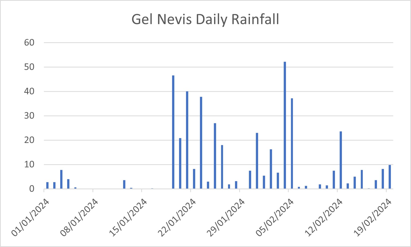
During a damp ramble up the hill, I got thinking about how much rain had fallen this season, it felt like it had been a wet one. According to the SEPA site in Glen Nevis there has been about 450 mm of rain since the 1st of January. For context some places on the East Coast of Scotland the average annual rainfall is around 550 mm, so only slightly greater than what Glen Nevis has received the last month and a half. Due to orographic lifting it tends to be wetter the higher up the hills you go, so the higher summits of Lochaber will have received significantly more precipitation. Unfortunately not all of this has fallen as snow!
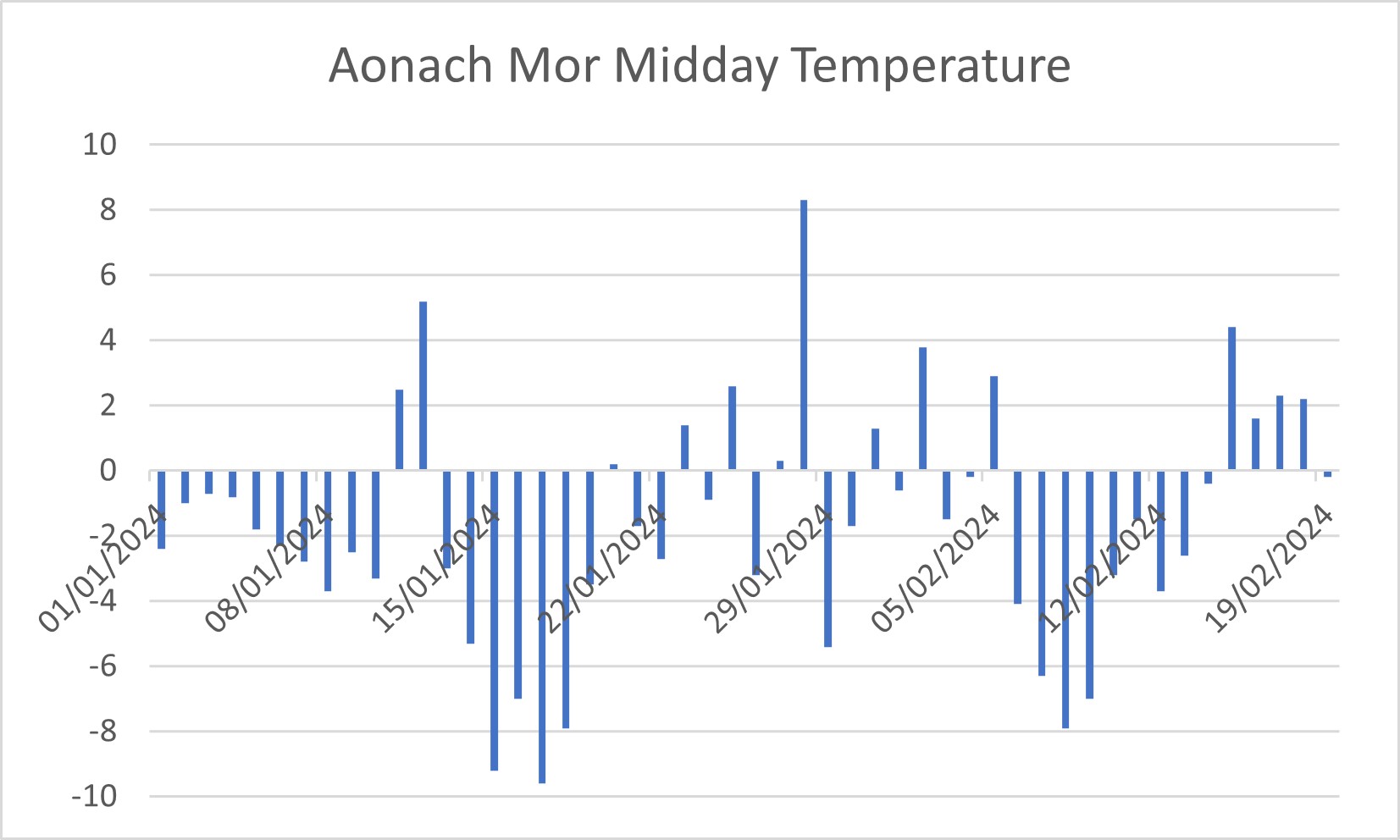
According to the SEPA station ( https://www2.sepa.org.uk/rainfall/ ) out of the 51 days the start of the year, there have been 12 days when no precipitation was recorded (10 of these days were between the 6th and 18th of January inclusive). These days were generally cold day, in all but one the midday temperature at 1200 metres was well below freezing. The average midday temperature for these days was -4.7C, while the average for the whole period (1st Jan-19th Feb) was significantly warmer, around -1.7C.
In the two graphs below I have plotted daily precipitation totals over time, and Aonach Mor summit temperatures over time (both up to yesterday). It is clear that the wet periods (particularly the 19th Jan to 5th Feb) correlate with mild temperatures, and the cold temperature will dry conditions. It is however, worth noting that the rainfall data is the 24 hours up to 9am on the day it is recorded, so some/much of the rainfall that is recorded on say the 5th of the month, fell between 9am and midnight on the 4th. Therefore it might be rainfall best compared with midday temperature the day before.
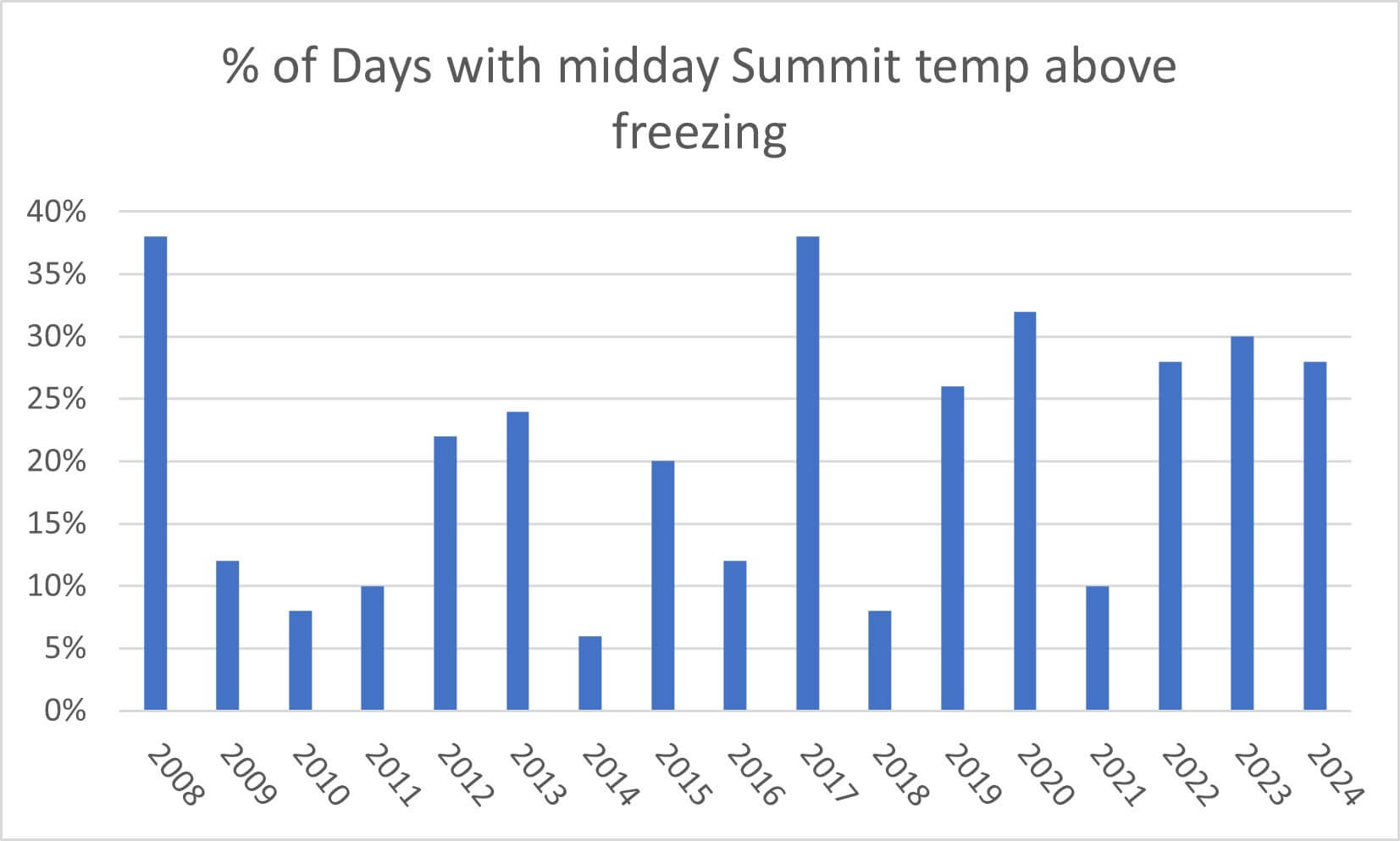
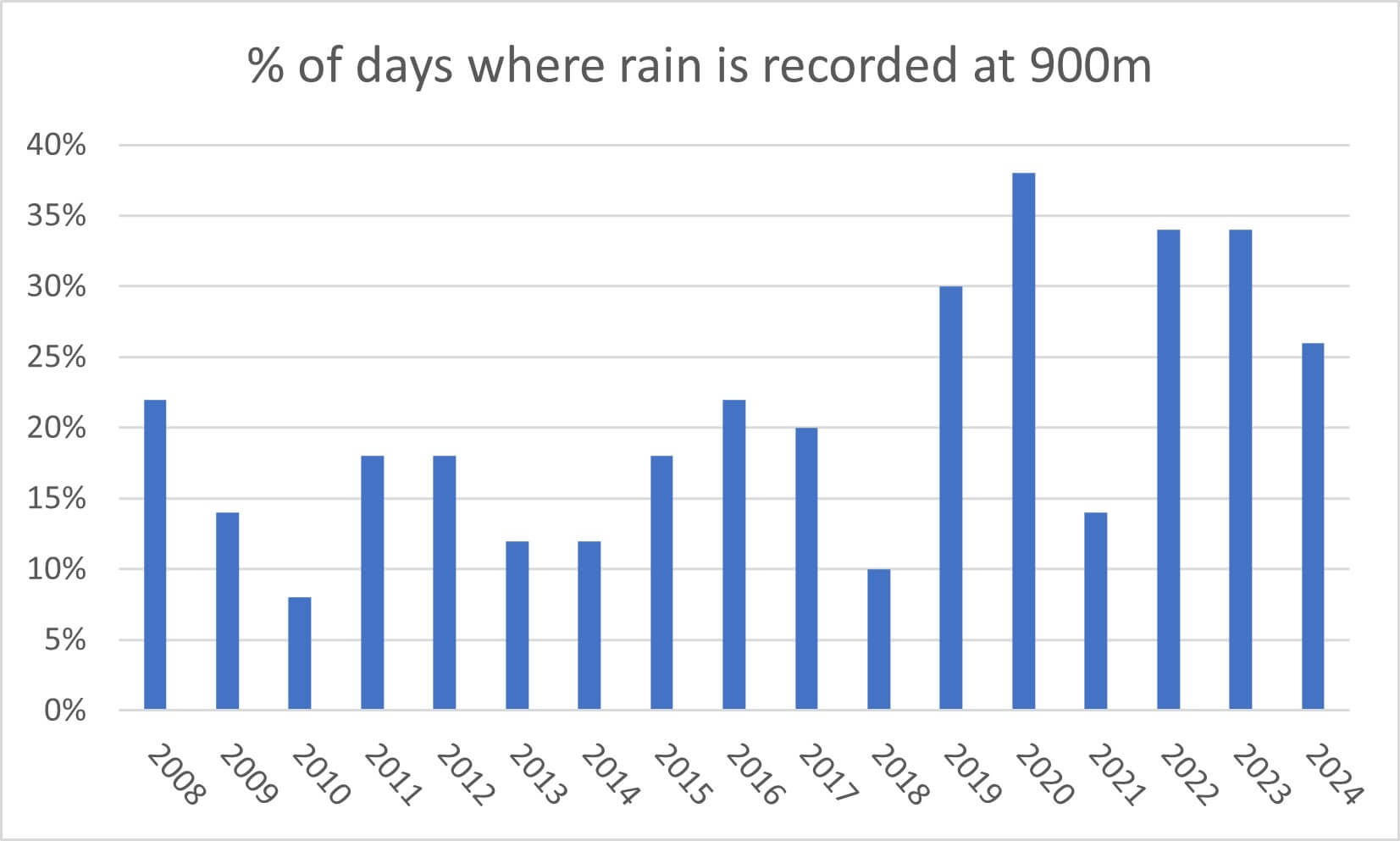
I also had a look at the percentage of days when the midday temperature was above the summit for the period 1st Jan to 19th of Feb, and the percentage of days rain was recorded at 900 metres in Lochaber. There appears to be a significant increase/change that occurs around 2019. Before that year rain had not been recorded on 25% of the days during the period 1st Jan to 19th Feb, since then it has been recorded 5 out of 6 winters. In fact this winter, wet as it has felt of the hill has not seen as many rainy days as 2019, 2020, 2022 or 2023.
Comments on this post
Got something to say? Leave a comment