A wee bit colder
25th January 2023
It was a wee bit colder than of late (but given how mild it has been that is not really saying much!). Above about 900 metres the surface of the snowpack was beginning to firm up through the day. With this trend continuing overnight a very hard and icy snowpack is expected tomorrow.
At higher levels the snowpack is freezing and becoming very hard and icy. With this trend continuing overnight and through tomorrow, the snowpack will be very hard and icy tomorrow.
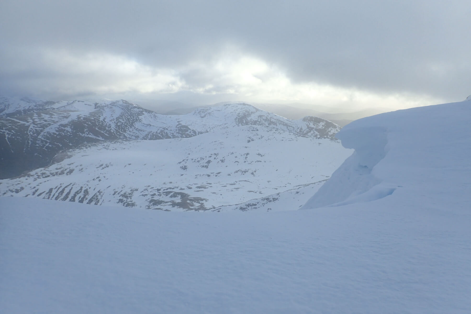
Still some sections of cornice remaining at the top of Coire an Lochan. The Grey Corries in the background.

Coire an Lochan. Despite the thaw of the past few days there is still a lot of snow in there for late January.

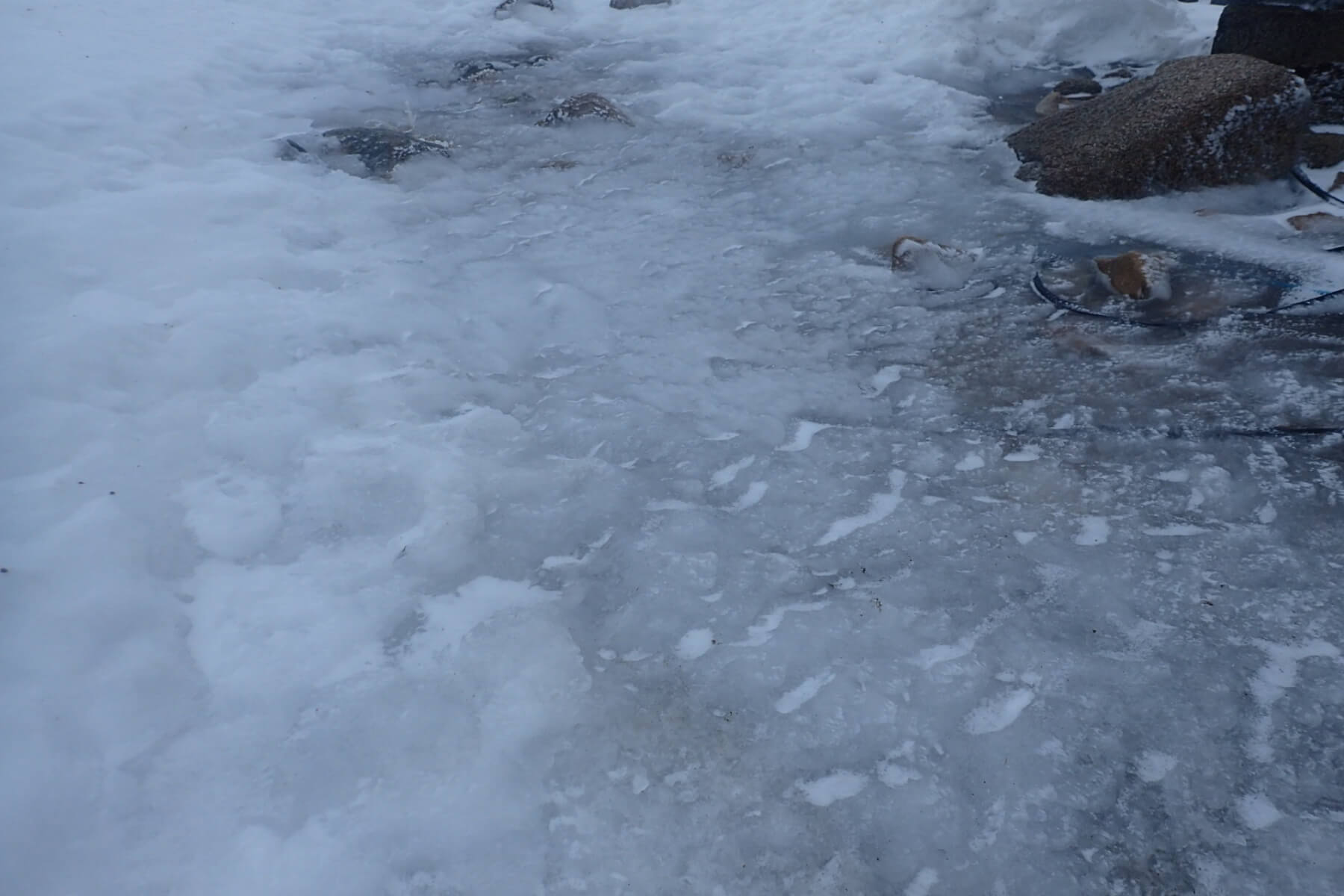
The view down to the Loch in Coire an Lochan. Being quite high this loch tends to freeze in December and usually stays frozen throughout the winter season.
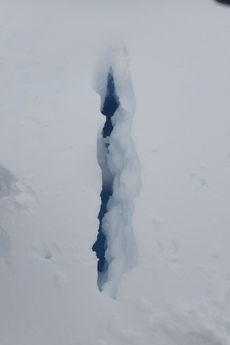
A crack caused from creep of the snowpack in the mild conditions of recent days.

Still plenty of water draining off the hills due to a combination of overnight rain and snow melt.
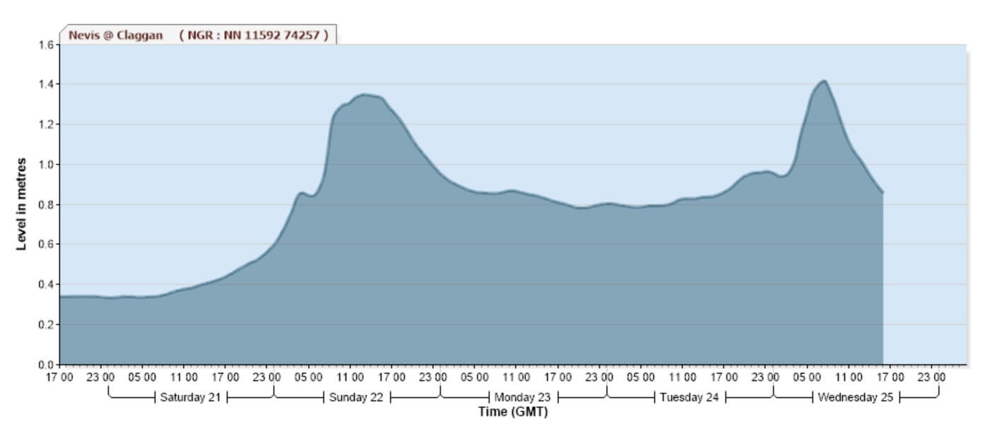
The water level for the River Nevis at Claggan for the last 5 days or so.
Despite the dry weather today there was still a fair bit of water coming off the hill. This is seen in the river level data for the river Nevis (above). River level data for many sites can be found on the SEPA website with data for the Nevis being at https://www2.sepa.org.uk/waterlevels/?sd=t&lc=116011 . Unsurprisingly the recent higher levels (from about Saturday evening until today) correspond to the mild conditions of the past few days. There does seem to be bit of a lag of a few hours due to the time taken for the peak flow to reach the monitoring station. For example, the second peak at around 8am today is associated with with overnight rain between about 2am and 3am.
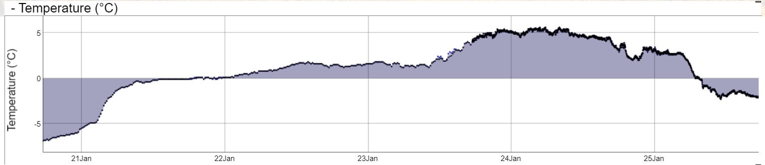
The Aonach Mor summit Temperature for the last 5 days or so.
Comments on this post
Got something to say? Leave a comment


