Winds of Change
12th February 2021

Ben Nevis this morning. In the picture it looks quite nice, but what you can’t see is the wind which was howling down the glen. The reason that the snow on the foreground not drifting in the strong winds is that it thawed a bit about a week ago and then refreeze to produce a solid enough crust to walk on.Â
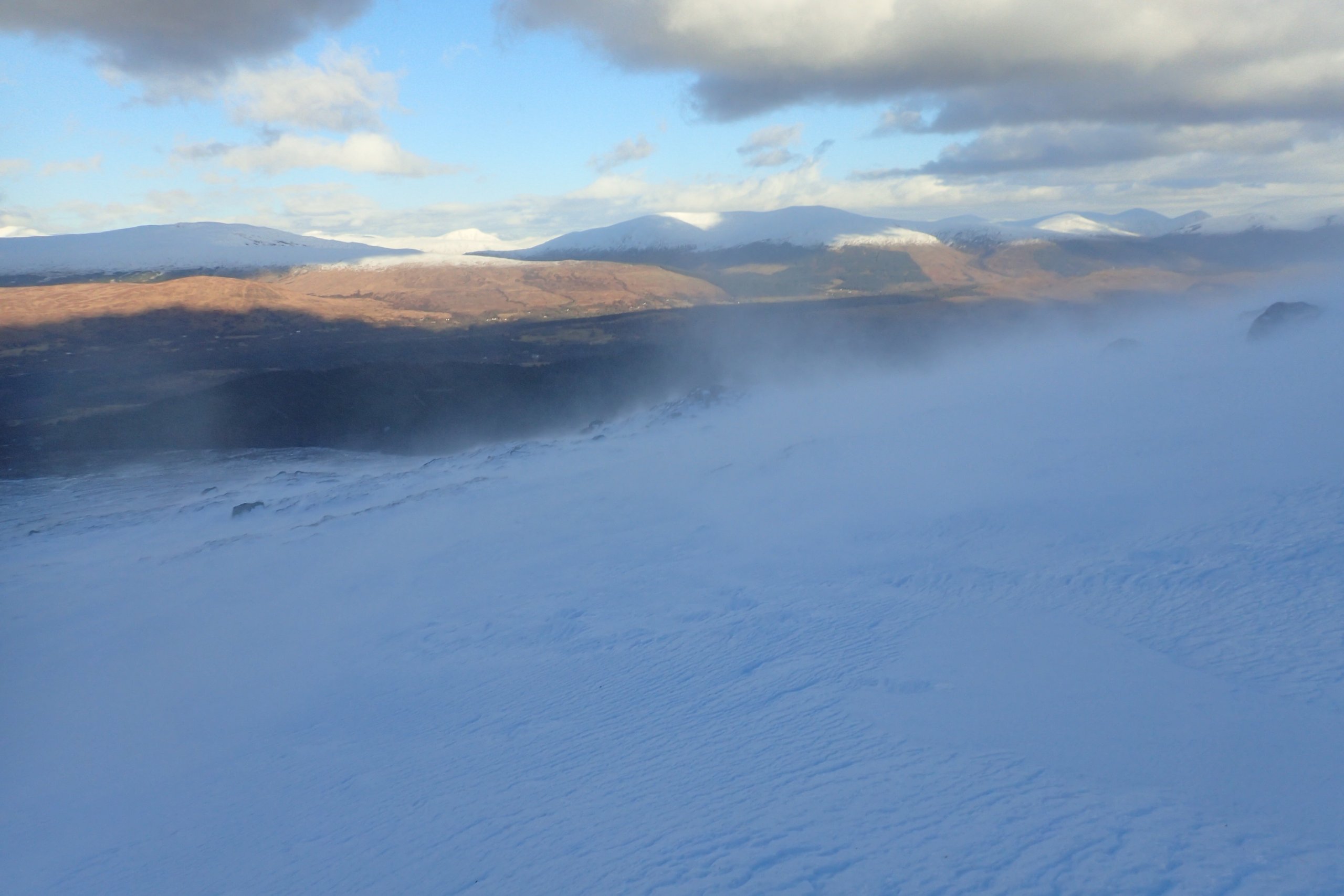
The view from the side of Carn Dearg Beag. It was windy enough to pick up some snow/ice crystals. Although the snow in the air was evident, I could only find a handful of pockets where it was being deposited. In very strong winds a lot of the blowing snow does not settled on the hill, it either sublimates back into the atmosphere, or gets blows into the glens. Snow being blown of Aoanch Mor was creating gently snowfall at the Nevis Range carpark this morning.Â
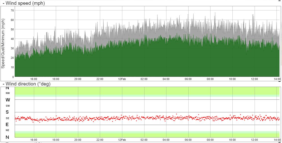
Data from the weather station on Tower 17 at 650 metres. Most of the morning it was gusting between 50 and 60 mph which is enough to make walking uphill into it quite hard work. The wind was consistently from the SE. Back on the 5th of February in the post Blowin’ in the (Variable) Wind, I speculated that the variability in the wind that day where due to the overall direction. However, the overall direction was the same (or at least similar) today, and yet there was little variability in the direction recorded at the T17.
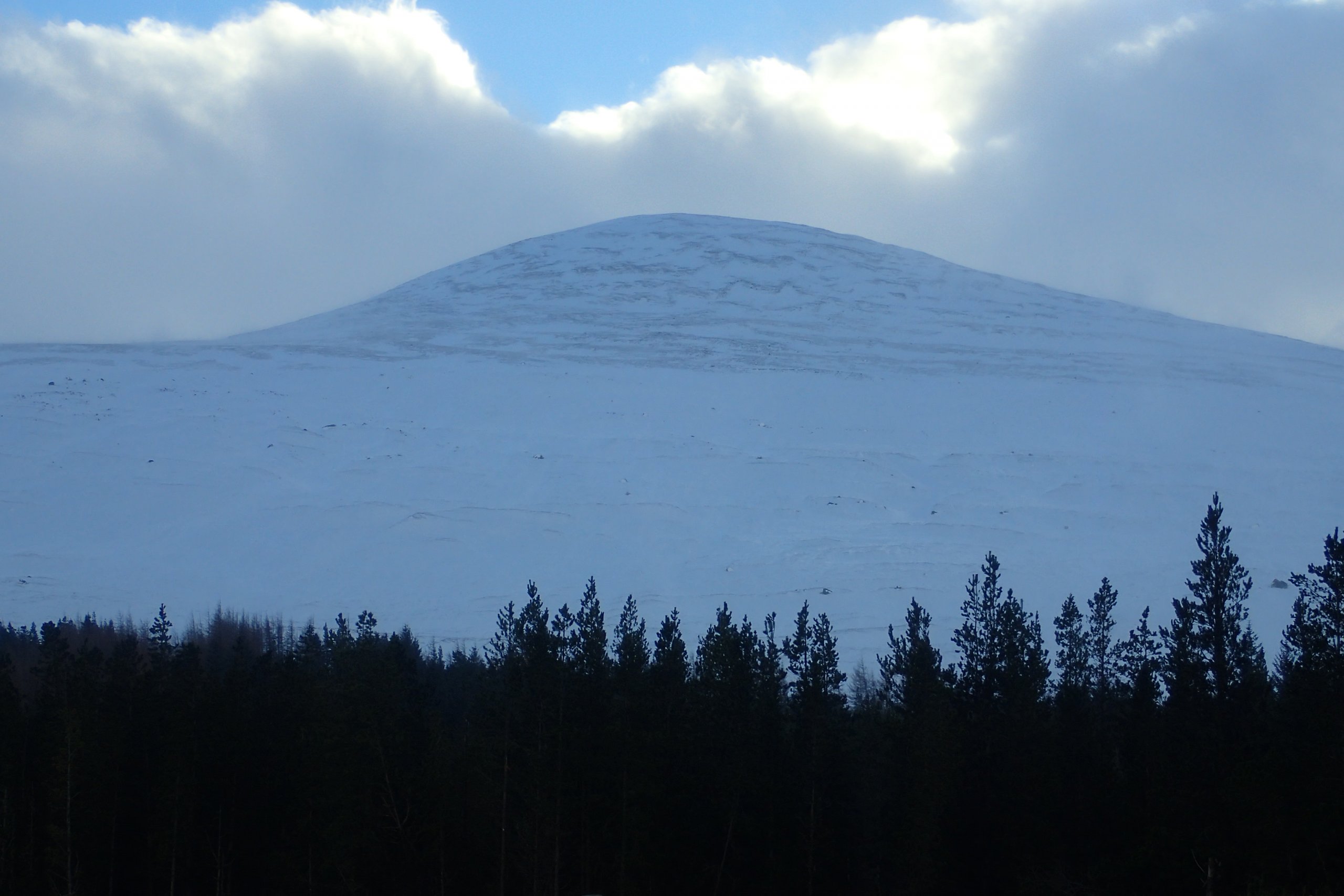
Looking back up Carn Dearg Beag. There is an obvious line below which it is a lot whiter. This will be due to the combination of temperature and windspeed when the snow fell. Below the level of the line the snow would have been damp and stuck to the ground, while at higher levels the snow would have been cold (and the windspeed higher), and just below across the ground. From my experience on this hillside today is it is all now pretty firm, with any soft snow being removed by the wind long ago.Â
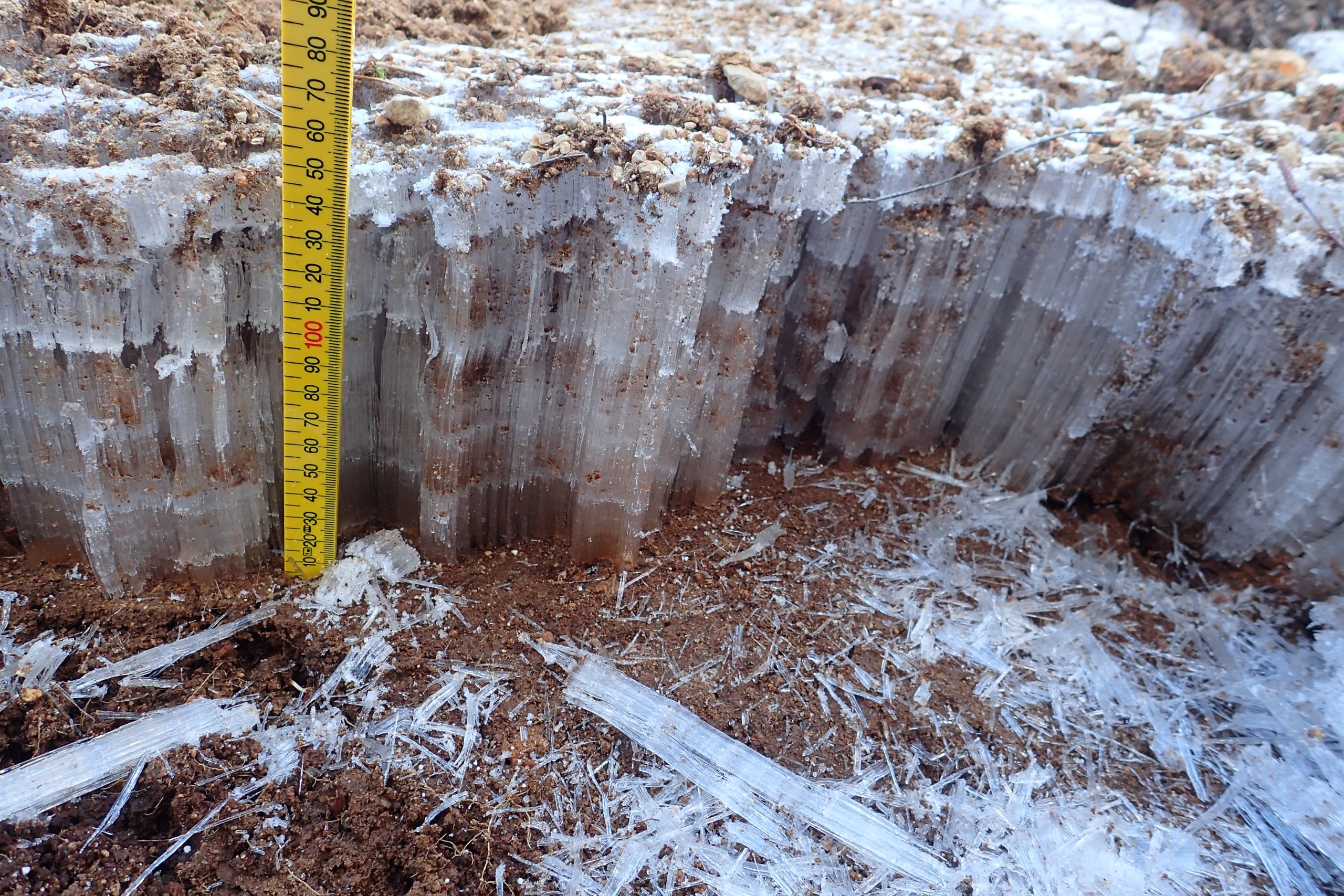
Needle ice. I spotted this great example of needle ice almost 15cm long on the way down the hill. I could explain how needle ice is formed, but thought that Wikipedia would do a better job of it https://en.wikipedia.org/wiki/Needle_ice
Comments on this post
Got something to say? Leave a comment


