Low Humidity Morning.
5th February 2023
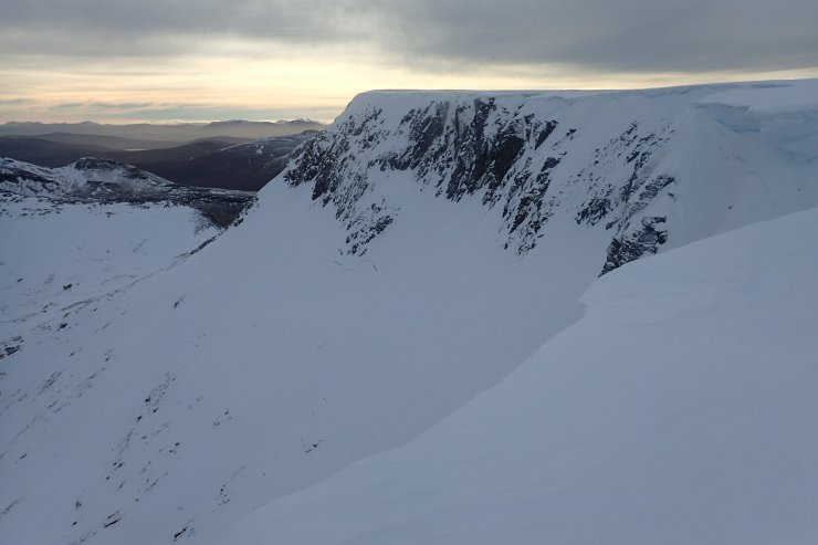
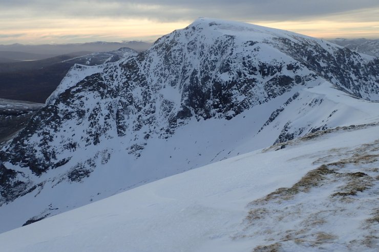
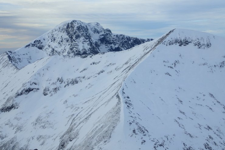
It was a clear dry day. The snowpack froze as the temperature dropped yesterday afternoon/evening. The freezing level did briefly rise above the tops but due to the low humidity (more on this further on) the snowpack remained hard, icy and stable. Although the hills don’t look very snowy as looking from the West side, once you get up into the high North and East facing coires there is a fair bit of snow. At higher levels the easier gullies tend to be complete, and there is some ice about. There were certainly a few climbers out and about today.
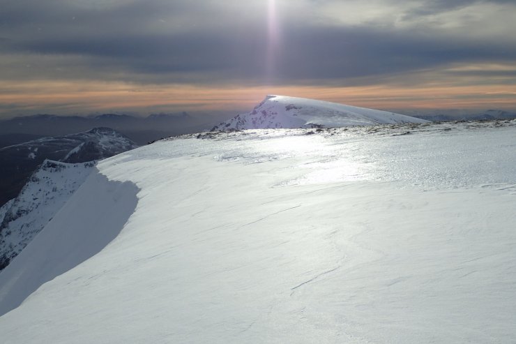
The sun briefly came out. You can see it glinting off the very hard snow-ice both in the middle distance and the far distance on the summit of Aonach Beag. The shallow deposits of less reflective fresh snow can be seen closer to the photographer. The fresher deposits were in general very shallow.
There seemed to be some interesting weather happening today with a few hours with very low humidity. The top pair of graphs shown below show the temperature, wetbulb temperature and relative humidity on the summit of Aonach Mor. From just before 7am to just after 1pm the actual air temperature rose significantly while the wet bulb temperature remained roughly constant. This led to very low relative humidity levels of about 20% around 10am this morning. In some ways this reminds me of a period last winter which I wrote about in this post https://lochaberblog.sais.gov.uk/2021/12/low-humidity/ One difference is that in that case humidity was low for a few days, while in today’s case it was low for just a few hours. A few years ago the BBC ran a story about low humidity values recorded on the summit of Ben Nevis https://www.bbc.co.uk/news/science-environment-47615716 which is worth reading. In it Prof Ed Hawkins of Reading University is quoted saying “Today, we recognise that dry air can sometimes descend from the stratosphere to near the surface in high pressure systems.”
I don’t know whether whether today’s low humidity was caused by, for the lack of a better term, a blob of dry air from the stratosphere descending at the edge of the high pressure which is currently centred to our South over England, or for another reason. Looking at data from the other holfuy stations which show temperature, wetbulb and relative humidity it can be seen that roughly the same thing (although with more short term scatter) can be seen occurring at the Quad about 300 metres lower on Aonach Mor. Going over to the Creag Meagaidh station (about 15 to 20 miles in a straight line) it is clear that something similar happened about the same time, but not nearly as pronounced with the relative humidity only dropping to around 70%. A bit further East and at slightly lower altitude at the Drummochter holfuy there there was no sign of this event. Over in Glen Coe there was also something unusual going on with the temperatures with a warming on the summit coinciding with a temperature drop at low level, see the SAIS Glen Coe blog for more details.
Although a keen observer of weather, and particularly winter mountain weather, I am not a meteorologist by trade, and ideas about a blob of dry air descending from the stratosphere are getting beyond my pay grade. However, if anyone is out there who knows a bit more about this, it would be great to hear your comments.
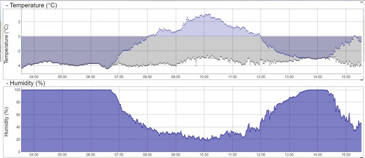
Temperature, wetbulb and relative humidity on the summit of Aonach Mor. The relative humidity got down to about 20% around 10am. I suspect this is the lowest it has been this season, and possibly since December 2021 when it got down to a similar level.

Temperature, wetbulb and relative humidity at the top of the Quad at 900 metres on Aonach Mor. Again the relative humidity was down about 20% but in this case it was slightly earlier, between about 8am and 9am.
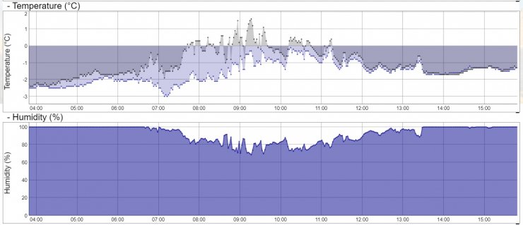
Temperature, wetbulb and relative humidity from the holfy device in the Creag Meagaidh area (a few miles East of the summit and at an altitude of about 900m). The humidity did drop this morning, but only to about 70%.
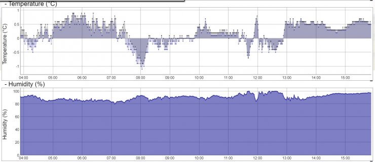
Temperature, wetbulb and relative humidity from the holfy device above the Drummochter Pass at an altitude of about 700m. No drop low humidity period was observed here today.
Comments on this post
Got something to say? Leave a comment
