Windy and still cold
19th February 2025
Today will mark the end of a very settled period of weather. For the last 2 weeks we’ve had a mainly South-Easterly wind, strong at times, low temperatures and minimal precipitation. It all changes overnight, and tomorrow there will be rain to summit level and above and gale force South-South-Westerly winds. Much of the snow cover at the moment is a fairly thin layer and this will thaw quickly in these conditions. Ice and the deeper areas of snow will take longer to melt. The temperature is forecast to be above average for the time of year until the end of the weekend so it will be interesting to see what survives the thaw.
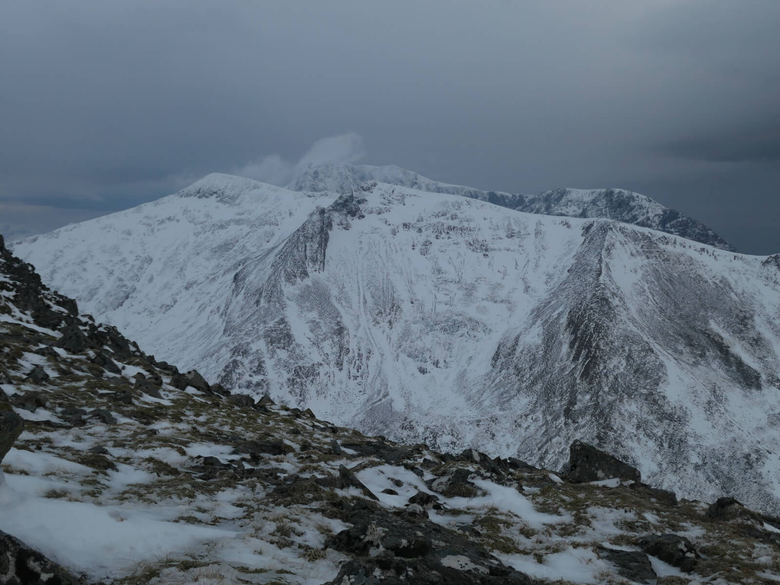
Carn Mor Dearg with Ben Nevis behind.
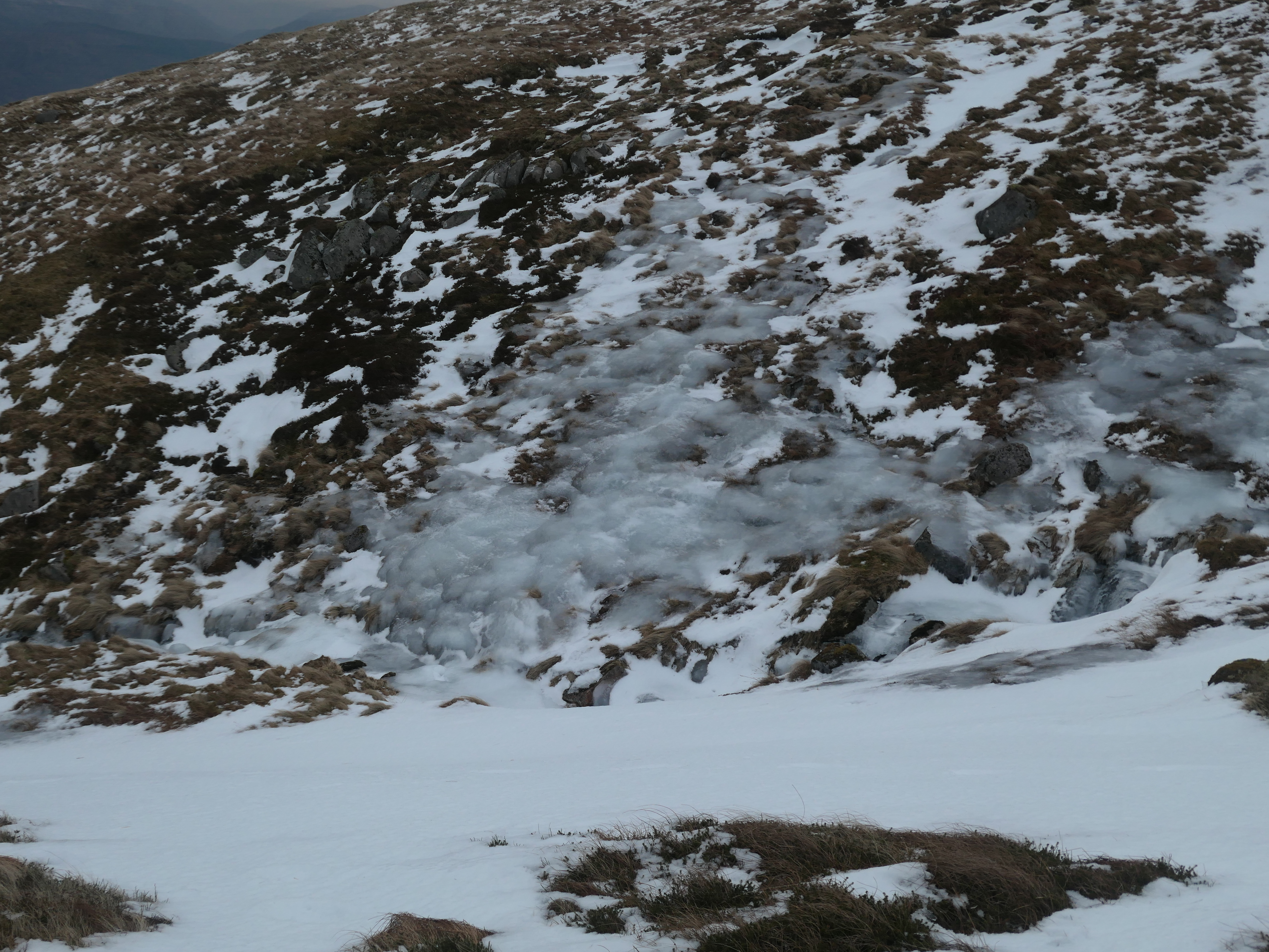
Snow and ice at 750 metres on Aonach Mor.
I got caught out slightly by the temperature today. I’d noticed before I set off that the summit temperature on Aonach Mor was around zero but a couple of hours later it had dropped to -4 degrees and combined with a very gusty wind there was significant windchill. The graph below clearly shows the quick temperature drop between 08:00 and 09:30.
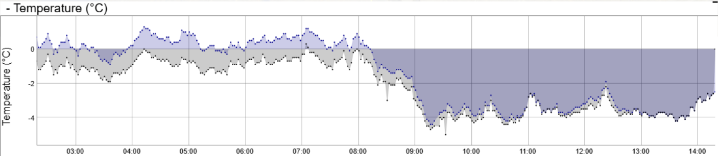
Temperatures at 1200 metres on Aonach Mor today.
Comments on this post
Got something to say? Leave a comment