Carn Mor Dearg
14th April 2021
Covid -19
The Scottish Avalanche Information Service issues information to support permitted activity under current Scottish Government guidance.
Please be aware of current mandatory travel restrictions in Local Authority areas within Scotland and respect local communities by referring to Scottish Government guidance and safe route choices for exercise.
This blog is intended to provide hazard and mountain condition information to help plan safer mountain trips.
It was a lovely spring day on Carn Dearg today. The snowpack softened through the day. It certainly feels like it is getting towards the end of the season now, and on that note I thought I would do a final few graphs to try and illustrate what has been going weather and snow wise this winter.

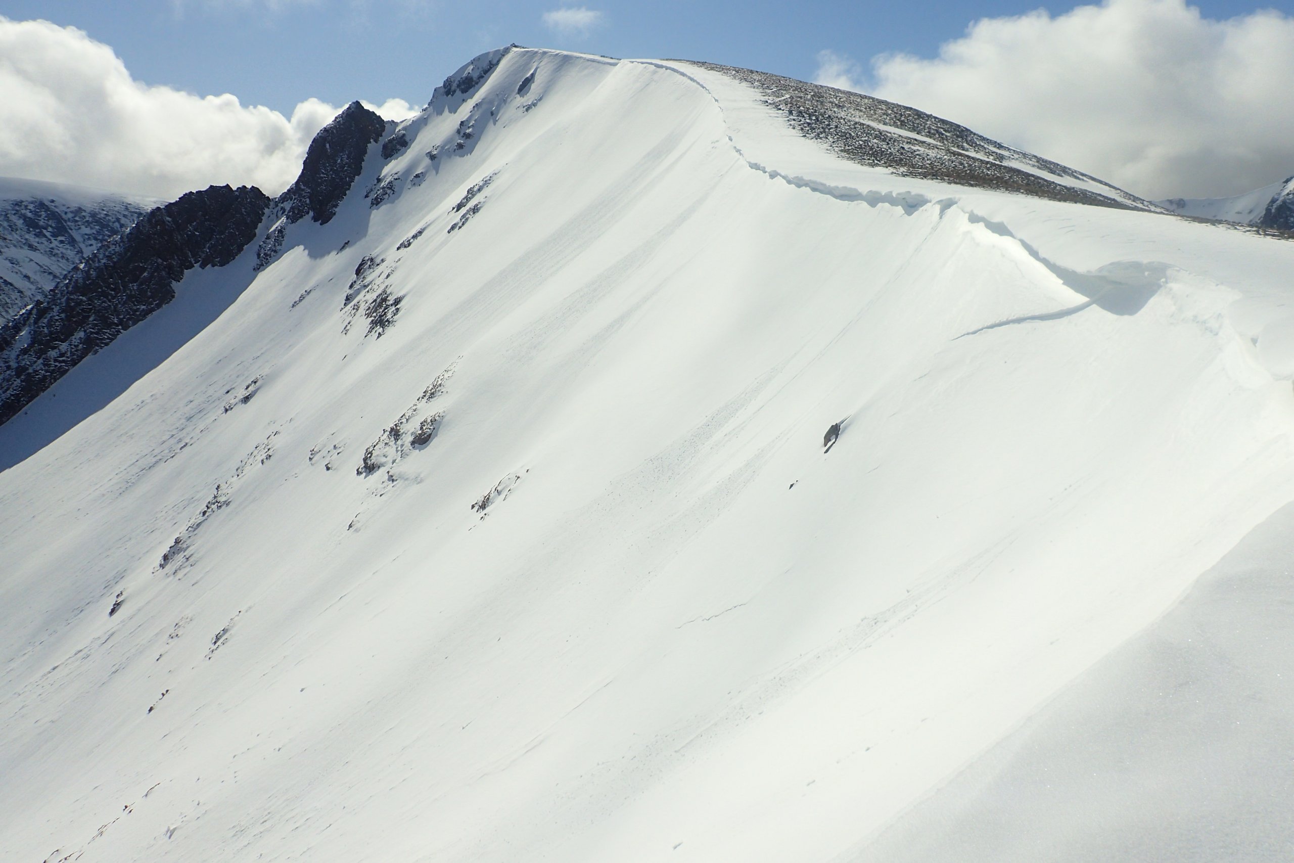
The Carn Dearg Meadhonach bowl. Notice the old crown wall running left down from an area where a cornice had collapsed. There are still some sections of cornice, such as just above the crown wall, that will be prone to collapse as the temperature rises.

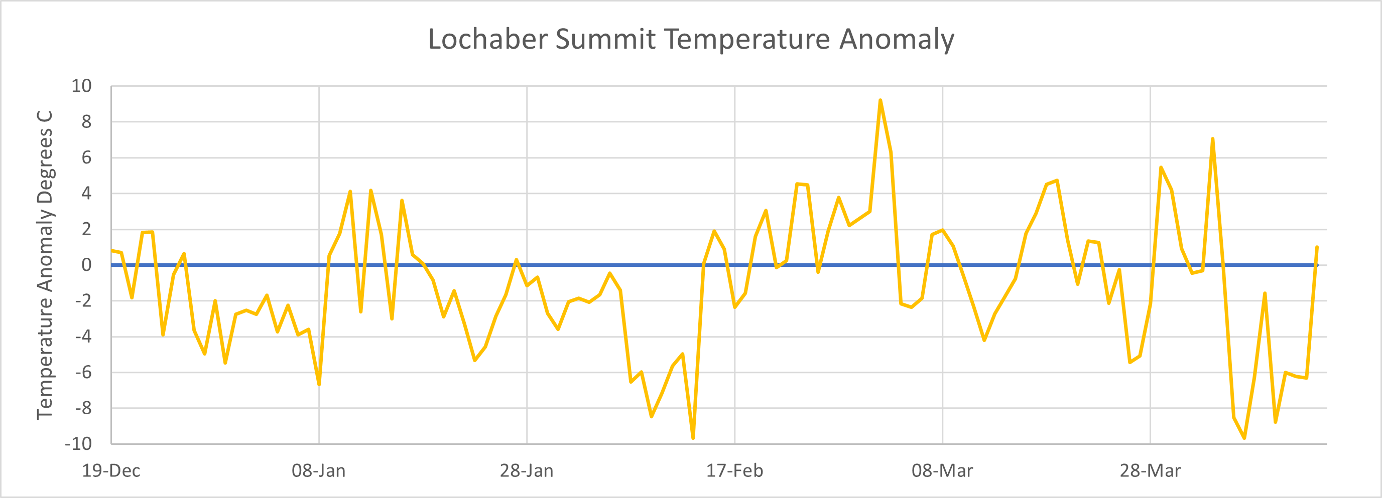
Given it is almost the end of the season, I thought I would do some final weather graphs. The first one above shows the Aonach Mor midday summit temperature through most of the season (from the 19th of December until now). Also shown in faded colours are the maximum, minimum and average values from the previous 14 seasons. One day in January, a number of days in mid February and early April set cold records for those days. A couple of days in early March and early April set warmth records for my wee 14 season dataset. The temperature was below average more than it was above average.Â

The Aonach Mor midday day temperature anomaly for this winter was predominately negative, particularly during the first half of the winter.Â

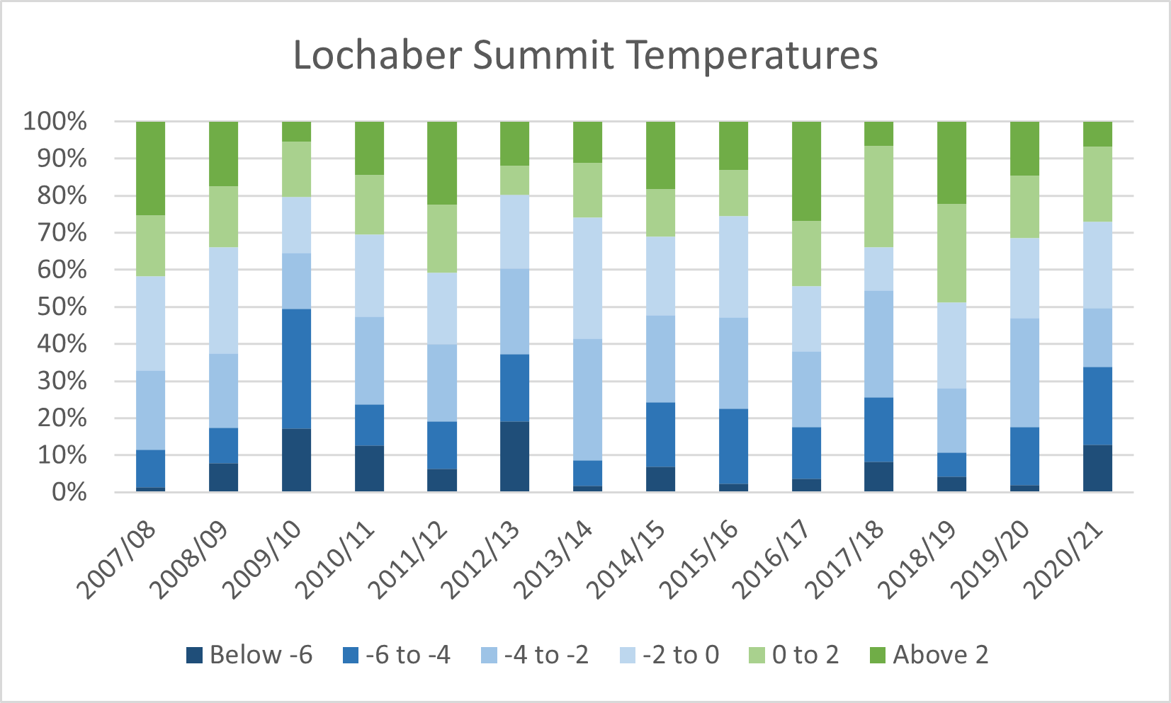
A chart of the range of summit temperatures in degrees Celsius for each of the last 14 SAIS seasons. This season was one of the colder ones, comparable with 2009/10, 2012/13 and 2017/18.Â

The percentage of days through the season that different avalanche hazard levels were actually observed. Despite the low temperature this year, it was in terms of the different hazard levels observed, one of the more stable seasons. No High hazard days were observed, the winter of 2016/17 is the only other season without a High hazard being observed. So far this season the observed hazard was Low of Moderate 67% of the days, only the winters of 2016/17 and 2018/19 having a higher percentage of Low and Moderate days. This is most likely because this year (like 2016/17 and 2018/19) was drier than average. We just did not get as much snow in Lochaber as during other seasons. Although I have not looked at the data I imagine it would be a very different story further East in the likes of the Northern Cairngorms where they had plenty of snow and a number of High hazard days.Â
Comments on this post
Got something to say? Leave a comment


Colin Wells
14th April 2021 11:12 pm
Loving the stats (& very fine photography) – keep ’em coming!
Tina C
15th April 2021 7:43 am
These blogs could form the basis of thought provoking book?
As usual will miss these reads when we move into summer.
Scott Whitehead
17th April 2021 8:52 am
Fascinating set of data there. Thanks. I had a look a stats for Cairngorm Summit last year after a trip up the Ben which may be of interest. https://wansteadmeteo.com/2020/11/05/cathedrals-of-snow/