A slow thaw continued.
8th April 2026
The thaw continued today, but not to the extremes of yesterday. Summit temperatures around mid-day were around +2 degrees (as opposed to yesterdays +9 degrees). With the wind in the South-Westerly quadrant it brought the usual poor visibility to the high tops. Clearing later in the day. The impact of the past 48 hours thaw has been significant, remaining snow is now above 900m mainly on North and East aspects. Wet snow instabilities remained, but there was a general stabilising trend in the snowpack as the day progressed.
It’s all change again tomorrow with the freezing level dropping to around 700m. Overnight rain is expected turning to snow showers as the freezing level lowers. Fresh deposits of wind slab are expected to accumulate on North through East facing slopes above 900 meters during the afternoon. This will mainly affect areas such as steep corrie headwalls and gully exits. These accumulations are expected to be small and easily avoidable. Elsewhere, the snowpack will continue to consolidate and be generally stable.
Photos below give a flavour of conditions today on the North side of Ben Nevis. (Thanks to Matt & Dave for some of the photos).
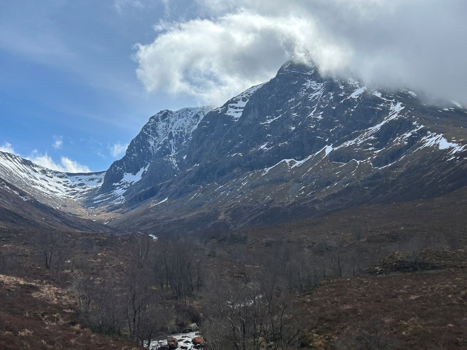
A view of the North side of Ben Nevis looking up the Allt a’ Mhuilinn when it cleared in the afternoon. Not much snow visible in this photograph.
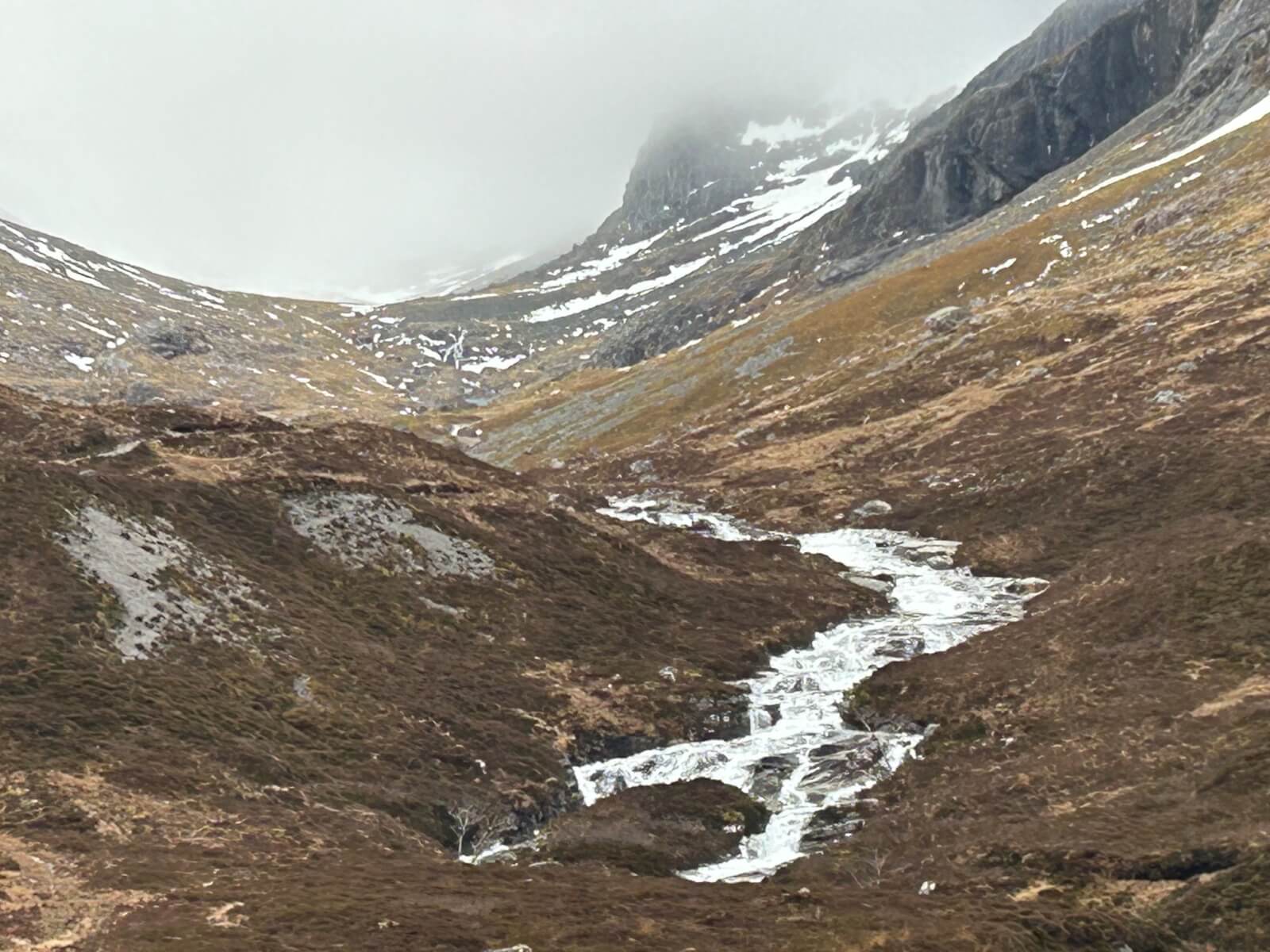
This is where all the snow has gone! The Allt a’ Mhuilinn was in spate, making burn crossings a little more challenging than normal.
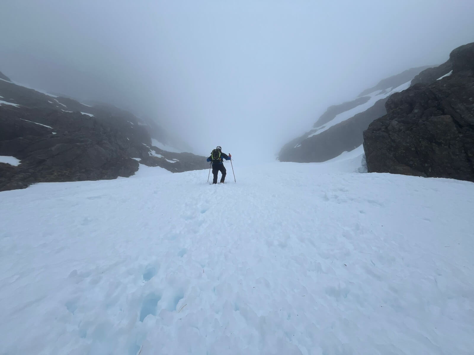
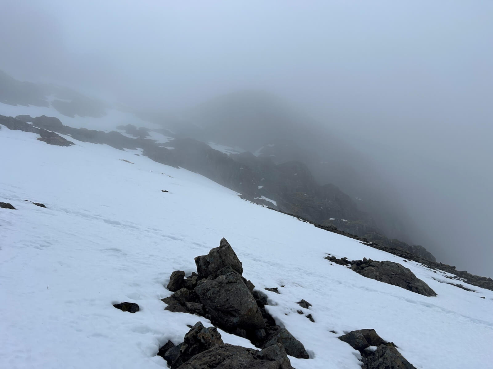
Heading into the mist. A photo looking up Observatory Gully around 850m. The snow at this altitude was very soft.
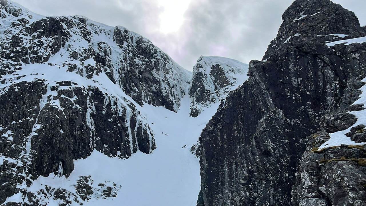
Looking across from Tower Ridge to the top of Gardyloo Gully as the cloud started to clear. Some ice still hanging in there on Indicator Wall.
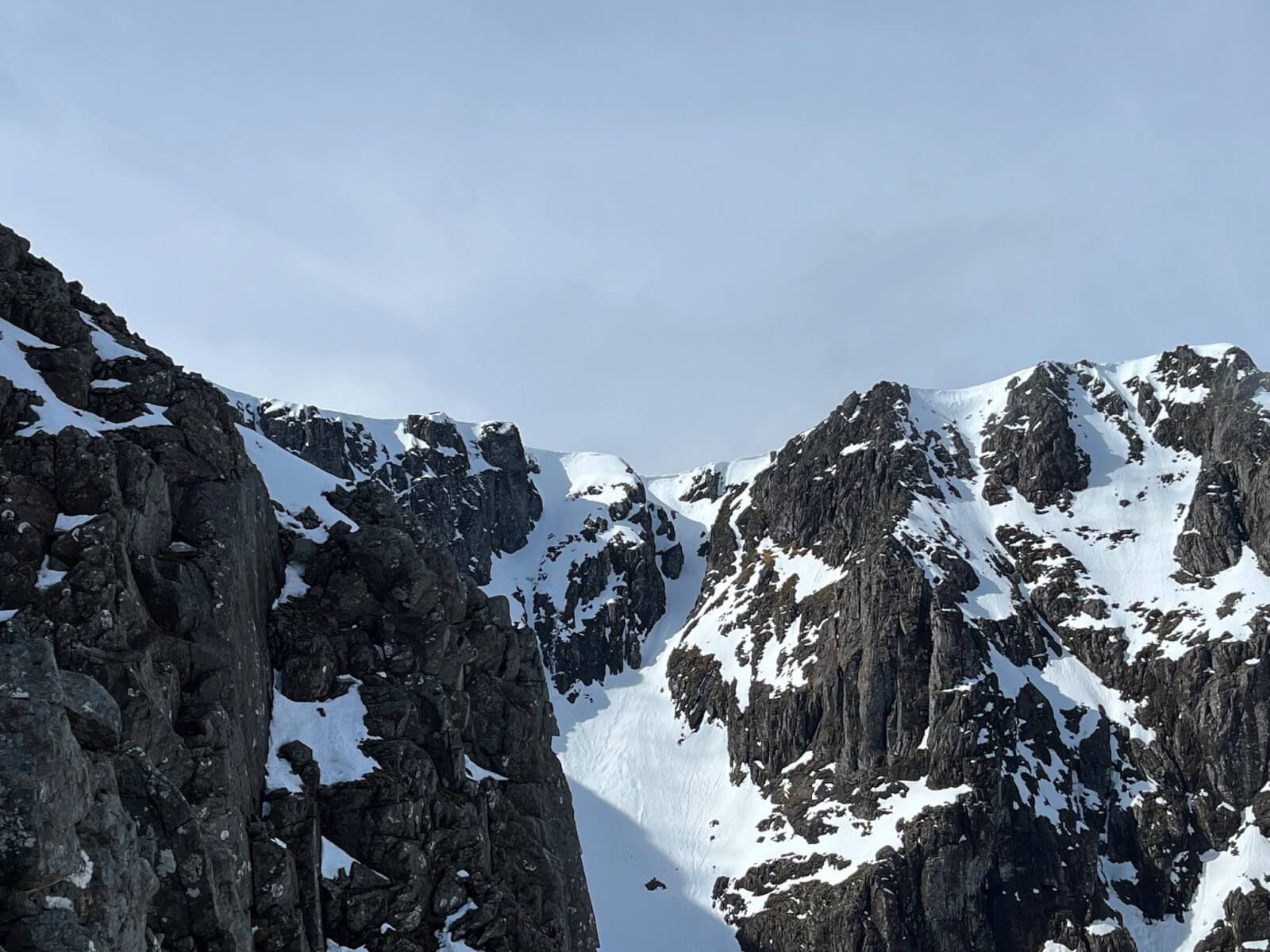
Looking across to the top No 5 gully. Some cornices remain.
Historical wet snow avalanche debris fanned out below No 5 gully.
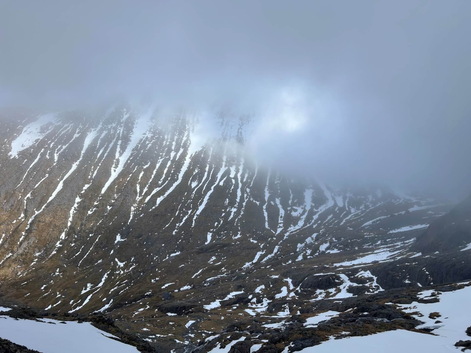
West face of Carn Mor Dearg. Only ribbons of snow remain on South & West facing aspects.
Comments on this post
Got something to say? Leave a comment