The Calm before the Storm
4th April 2026
It was a pleasant and settled morning. Despite an early start it clouded in just as I reached the plateau, so the views over to Ben Nevis or Aonach Beag were not to be. There had been a reasonable amount of overnight snow, and a couple of small cornice triggered avalanches were noted.
All change into the afternoon as storm Dave approaches. The wind has been getting up and it has been snowing consistently up the hill for the past few hours. As I type it is snowing heavily down to sea level in Fort William. A fair bit of weather is expected overnight and through the day tomorrow before hopefully calming down on Monday.
Not the best photos today due to the poor visibility, so included a few weather analysis charts at the end of the post.
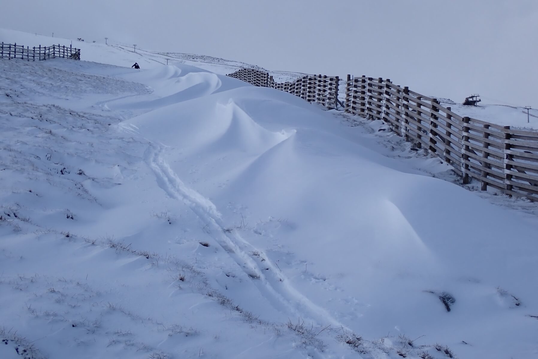
Snow fences caught yesterday’s snowfall at 750 metres. You can just see the last member of team early skinning up the hill. They looked to be able to get a run or two in before the visibility got too bad.
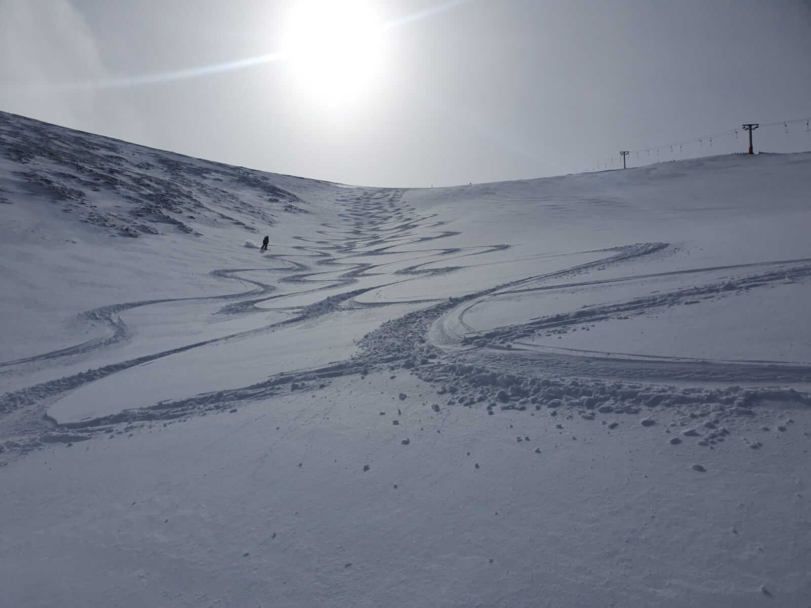
Looking into Coire Dubh. The three dots down to the left are team early, looks like they had a good ski, you can make out their tracks. Debris from a couple of small cornices triggered avalanches can be seen off to the right of the shot.
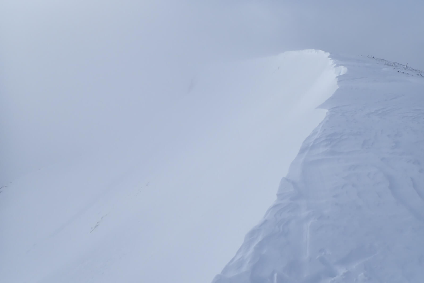
Looking along the lip of Coire Dubh as the visibility went.
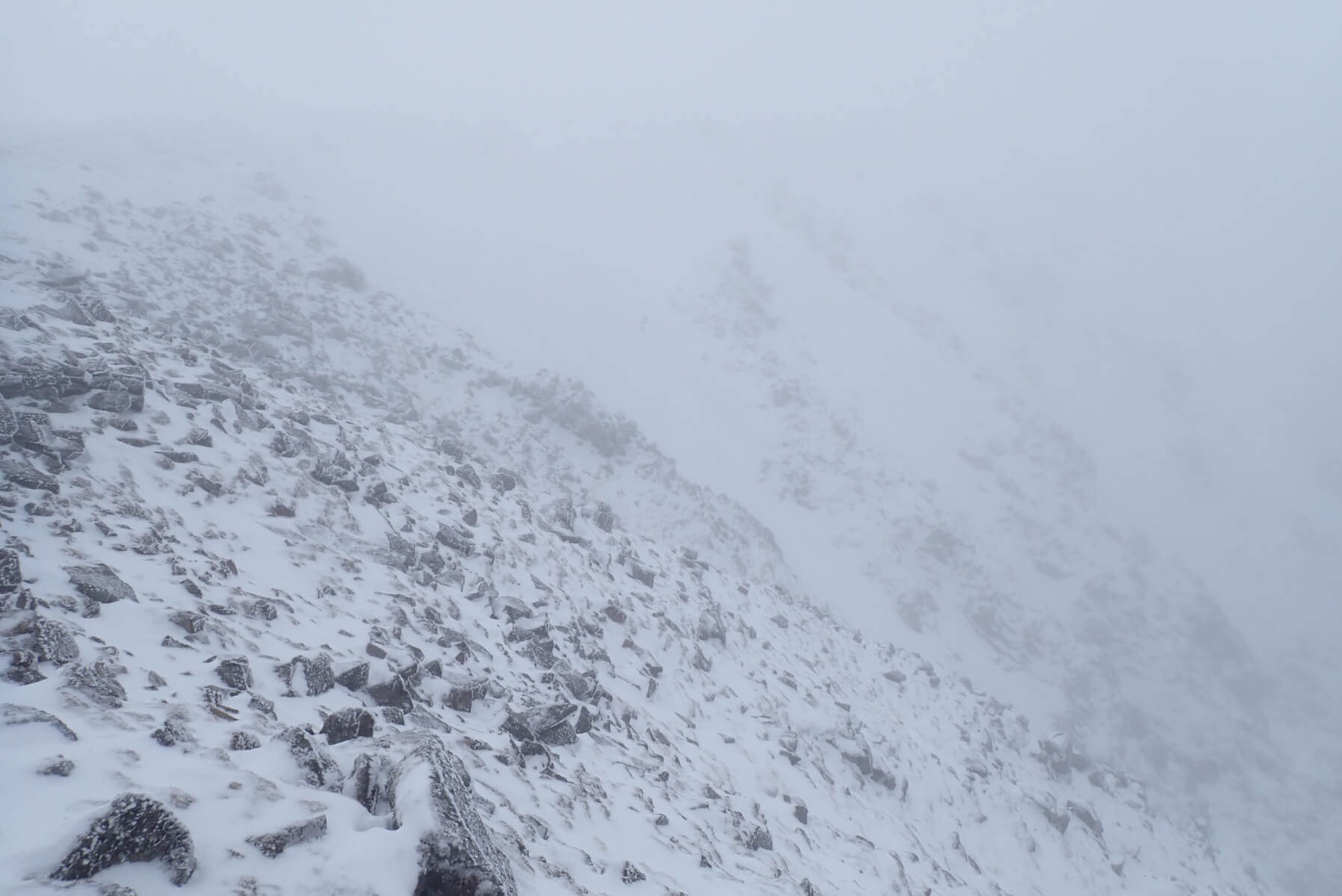
The top of the West face from near the actual summit of Aonach Mor. Quite scoured but the gully lines holding snow.
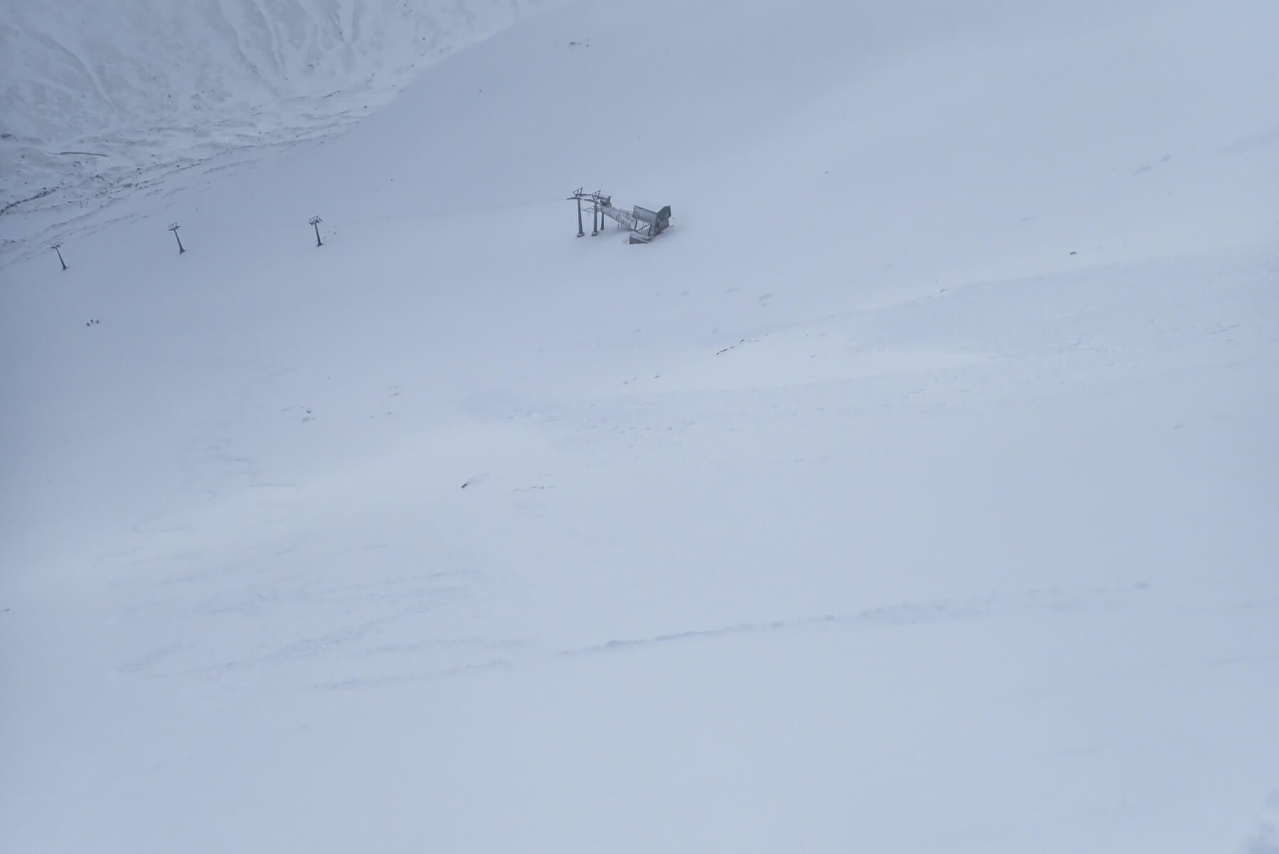
There was a brief clearing late morning when I was on my way down. Team not-so-early timed it well and found some nice snow. Within half an hour the cloud had rolled back in and visibility has dropped right off.
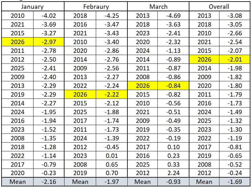
The Aonach Mor summit temperature for January, February and March for the past 19 years ranked coldest to warmest. As can be seen January was relatively cold while February and March were around average. Overall it was the 6th coldest Jan-March period.
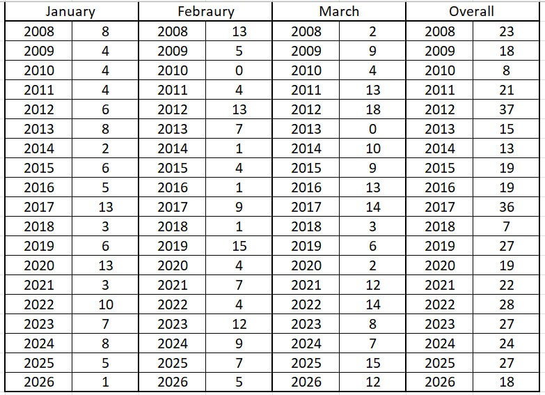
The number of days that the summit temperature was above freezing for each month. In terms of days above freezing this January was the least in the past 19 years with only one day above (although there were a few other days which were very close to freezing, or above freezing at other times of the day). There is only two months which have not seen a midday temperature above freezing through the month, they are Feb 2010 and March 2013. Overall you have to go back to 2018 to find a Jan-March with few days above freezing than this year.
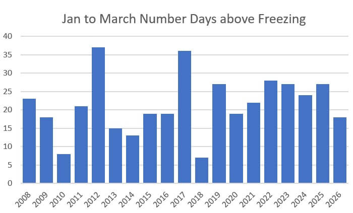
A graph showing the number of days above freezing on the summit at midday for the period January to March. The year to year variation looks much greater before about 2019.
Comments on this post
Got something to say? Leave a comment