Why Wet Grains Grow.
5th March 2025
It was a mild day with strong winds. The met office weather station on Aonach Mor was not working, but it was gusting over 70mph at the top of the gondola line at an altitude of 650 metres. Visibility was poor again, so no view of how much snow is left in the higher coires.
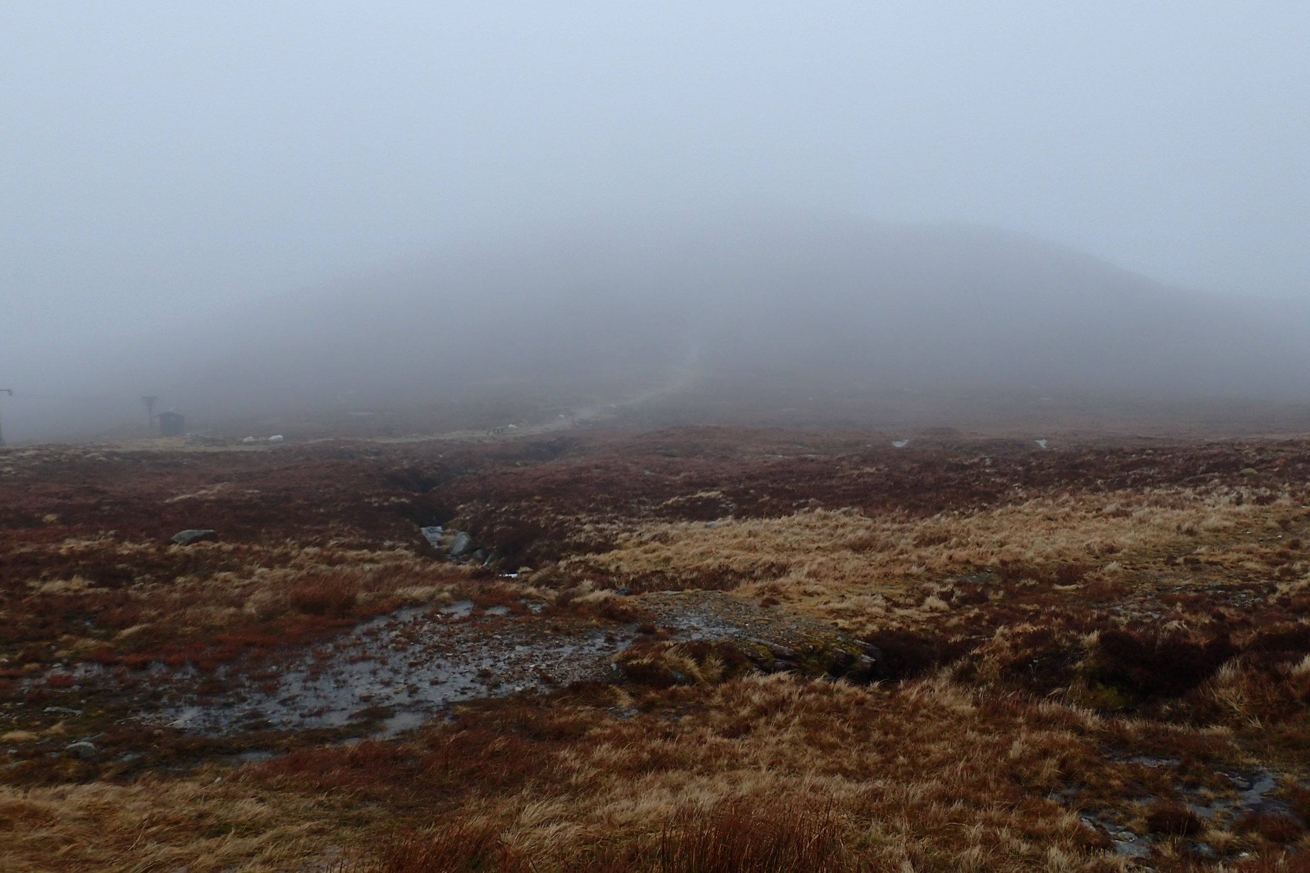
No magnificent panorama of the Lochaber hills today. Another day of poor visibility.
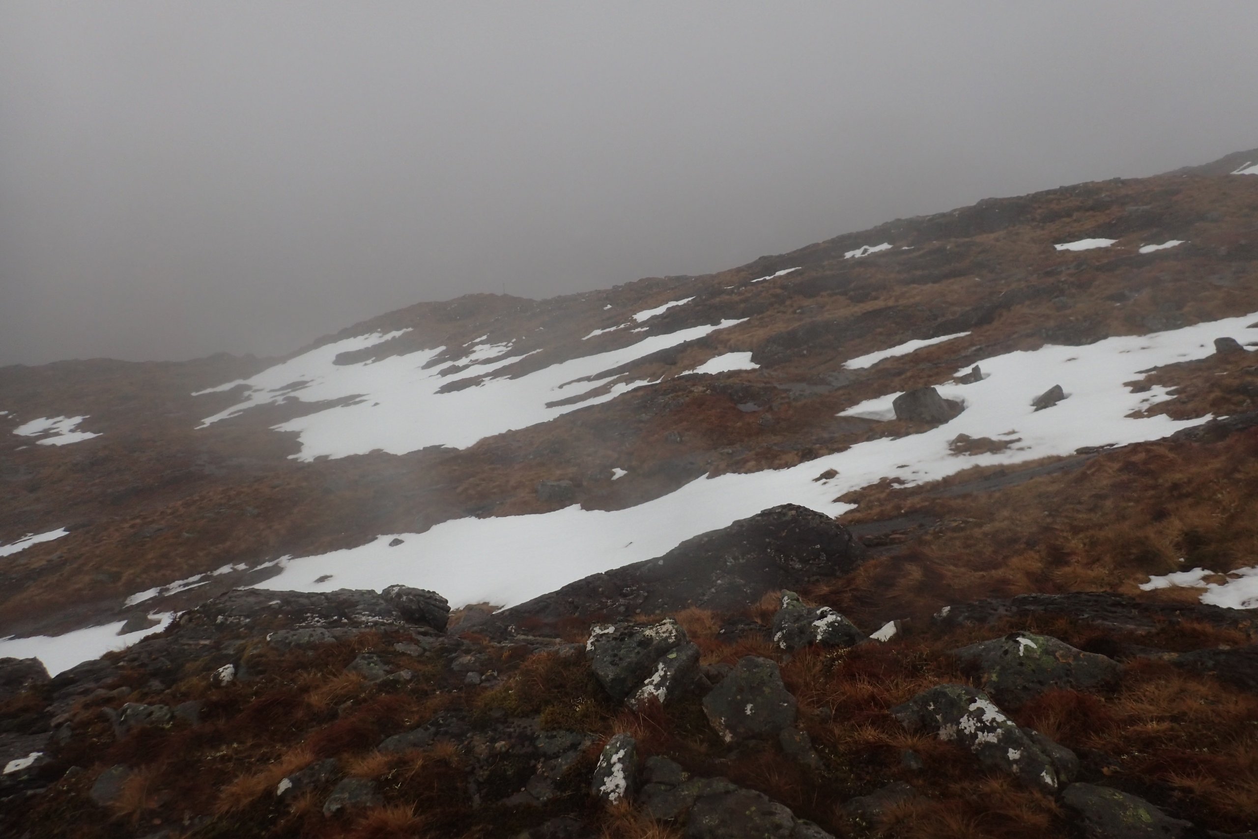
The snowpack is getting distinctly patchy.
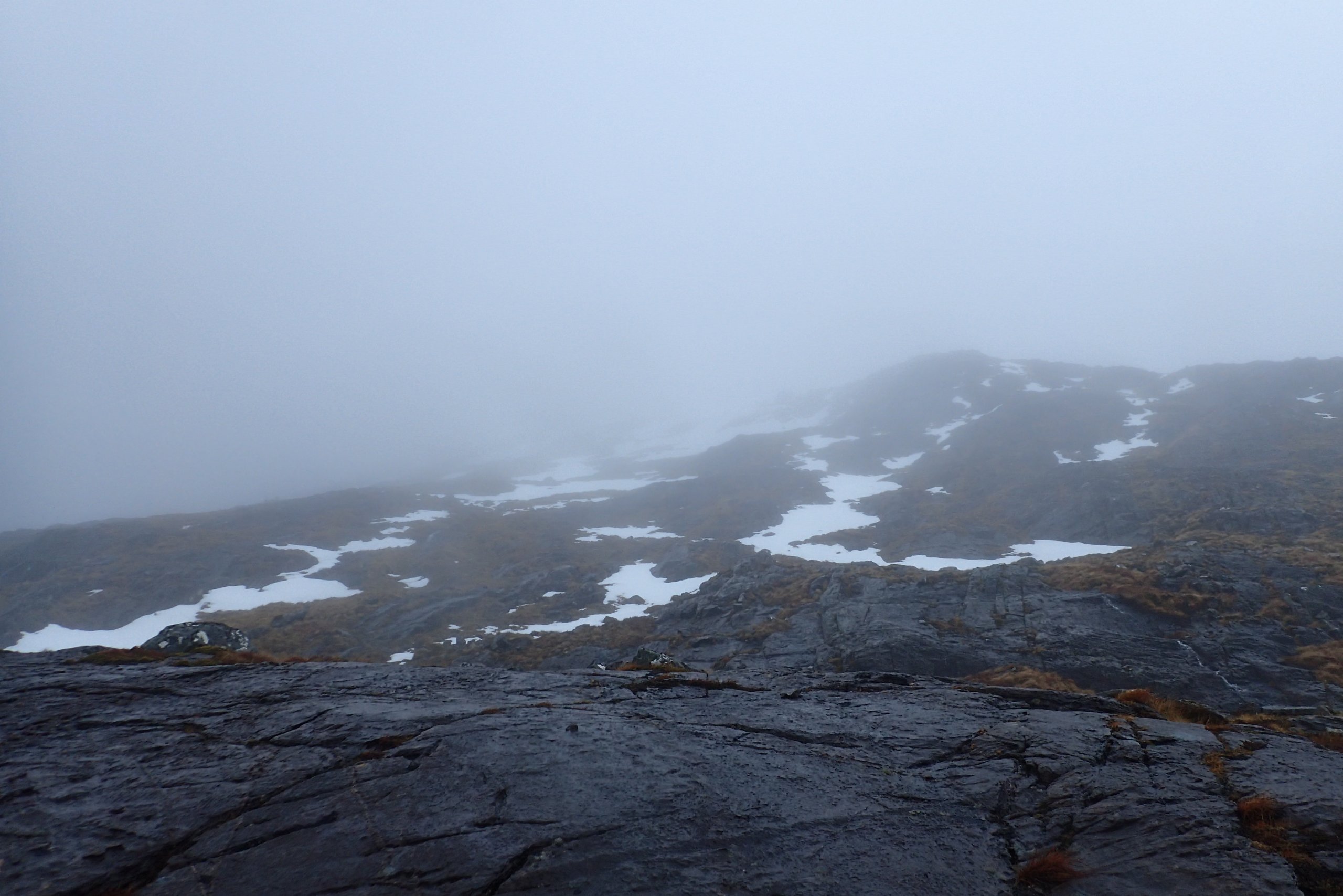
The view at about 850m on the East side of Aonach Mor.

The snowpack was turning to water quite rapidly in the mild conditions.
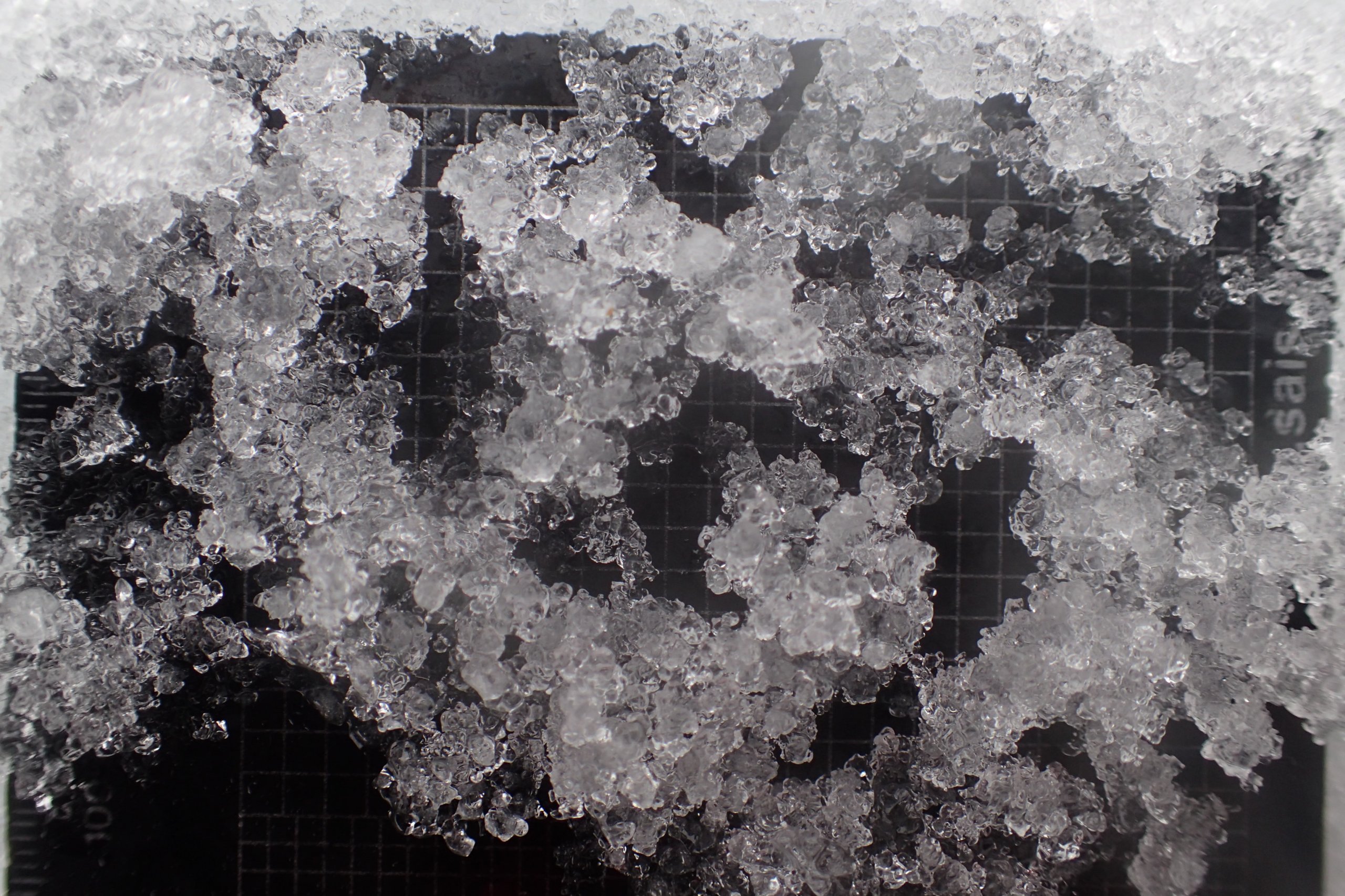
Today’s wet grains on a crystal card. The grid in the background is a 3mm grid. The grains are also about 3mm in size, which is pretty typical for Scottish wet grains.
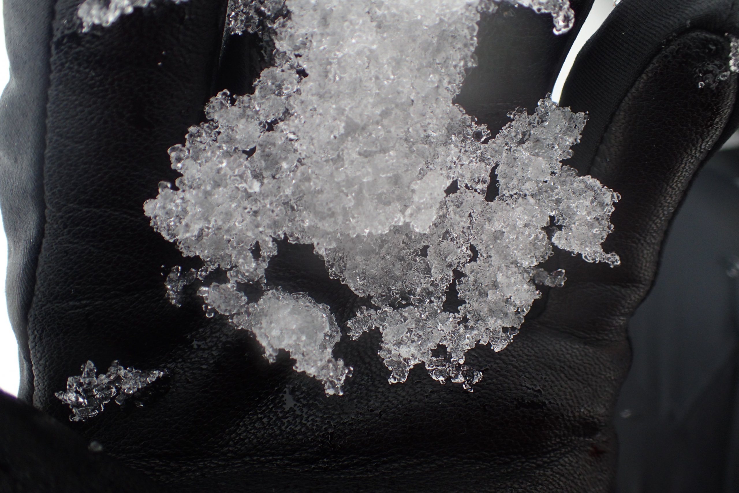
Today’s wet grains on my glove. Compare the size of these to cold grains (below) from a few weeks ago.

Fresh, cold snow on my glove a few weeks ago. The typical crystal size for small round is much smaller (typically 0.5mm-1mm) than wet grains (typically 3mm).
Today’s snowpack was wet with chucky grains of a size of about 3mm. This contrasts to typical Scottish dry cold snowpack in which the grains tend to be smaller. If you look at the snowpit data over the past few days, on the 1st, 2nd and 3rd of March the snowpack was cold (or at least not actively thawing) and in all these cases contained layers of small rounds with size of 0.5 or 1 mm. Yesterday and today the snowpack was actively thawing, and the snowpack consisted of melt-freeze polycrystal with a size of 3mm. None of this will come as any surprise (or be perhaps even very interesting) to those that are used to looking at the Scottish snowpack.
However, if you think about it, there is something interesting going on, how do little crystals of the scale of 0.5 or 1 mm grow to about 3 mm when the temperature is above freezing and they should be melting? You might argue that this is due to the re-freezing of the snowpack. However, this process occurs even if there is no refreeze. So what is going on? I recently found an explanation, a brief summary of which is given below:
The Gibbs-Duhem and Laplace equations dictate that the melting point temperature of snow at low liquid water content varies as the sum of negative linear functions of curvature and capillary pressure. In snow at higher liquid water content, the melting point temperature varies primarily as a negative linear function of curvature. What this means is that, in both cases, the more convex the crystal surface, the lower the melting point temperature around this surface.
This means that the local temperature gradients within a wet snow sample conduct heat away from the concave (or less convex) crystal surfaces towards the more convex surfaces. This process generates melting of the most convex surfaces, including the smallest crystals, and refreezing of liquid water onto the concave or less convex surfaces. This process lead to rounding and growth of the crystals. Small crystals (of any shape) grow to become larger and rounder.
There are limiting factors in this process, which in the Scottish climate seem to kick in when the crystals reach about 3mm in size. Continuing thaw conditions do not tend to increase crystal size significantly. However, the continuing thaw conditions will be reducing the amount of snow we have on the hills. Hopefully tomorrow will be a bit clearer to see what has survived so far.
Comments on this post
Got something to say? Leave a comment


Mike A
6th March 2025 9:16 am
I was wrong on the eagle identification and in-between reading my Collins guide I’d enjoy reading up on the above analysis.
Could you link to a source for where to read more on the metamorphism going on?
lochaberadmin
6th March 2025 2:58 pm
So the section on this blog post is based an a discussion in the book Snow and Climate edited by Richard Armstrong and Eric Brun. However, there is a fair bit of material available on-line (some good, some maybe not so good). One website where there is a lot of good videos on lots of aspects of snow and avalanche science is Bruce Jamieson’s website (https://www.brucejamieson.ca/videos).
Mike A
6th March 2025 6:55 pm
Primo. Just finished an episode of the avalanche hour podcast with Dr. Jamieson. I’ll check out Snow and Climate book.
Montana State’s subzero lab and the Gallatin National Avalanche Center are my go to sources for snow science.