Definitely wintry on the tops.
25th February 2025
Heavy snow showers over the last twenty four hours have deposited a fair amount of fresh snow at higher levels. It seems that Lochaber got a lot more snow than other areas, even close by Glen Coe. This, combined with colder summit temperatures and greater coverage of old snow, has meant that Lochaber has a more hazardous feel about it avalanche-wise than neighbouring areas. Although compared with other seasons the quantity of snow is not huge, there was plenty piling into the tops of the gullies and forming fresh unstable cornices.
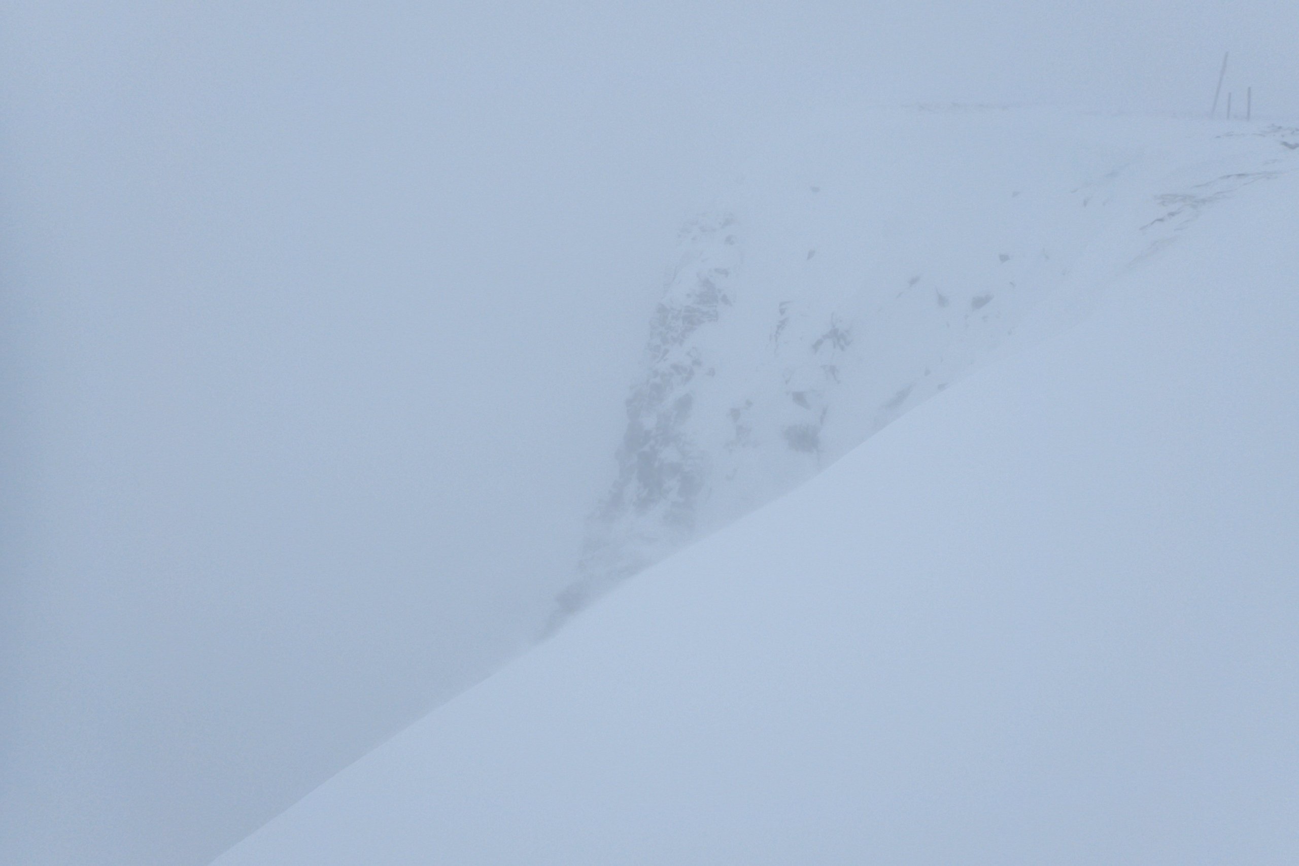
 The summit plateau of Aonach Mor looking a lot whiter than it did yesterday. This photo was taken in roughly the same spot as the the second photo in yesterday’s blog post.
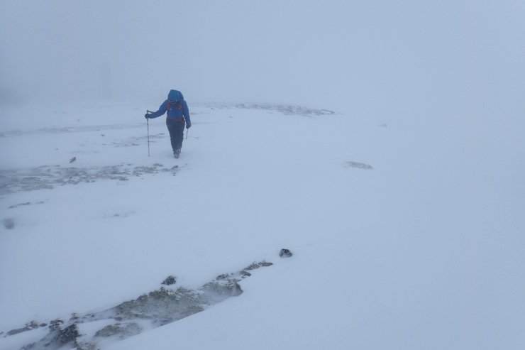
Visibility was poor this morning so not the best of photos of the crags of Coire an Lochan. In general significantly more snow about, and some fresh weak looking cornices.
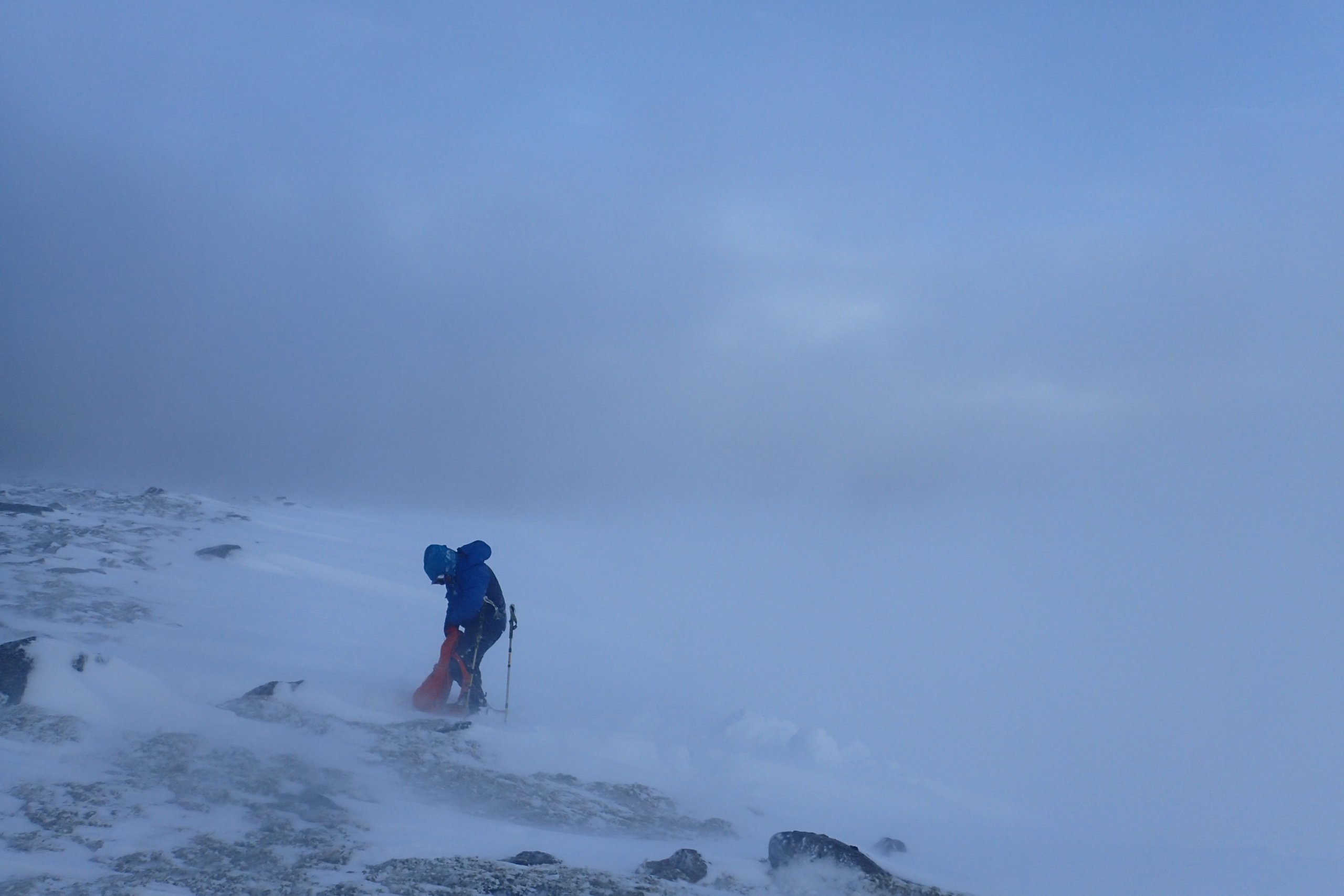
On the way down the hill there were a few breaks in the cloud. Although visibility remained poor at this level due to blowing snow for the time I was on the hill, there were some clear spells later on.
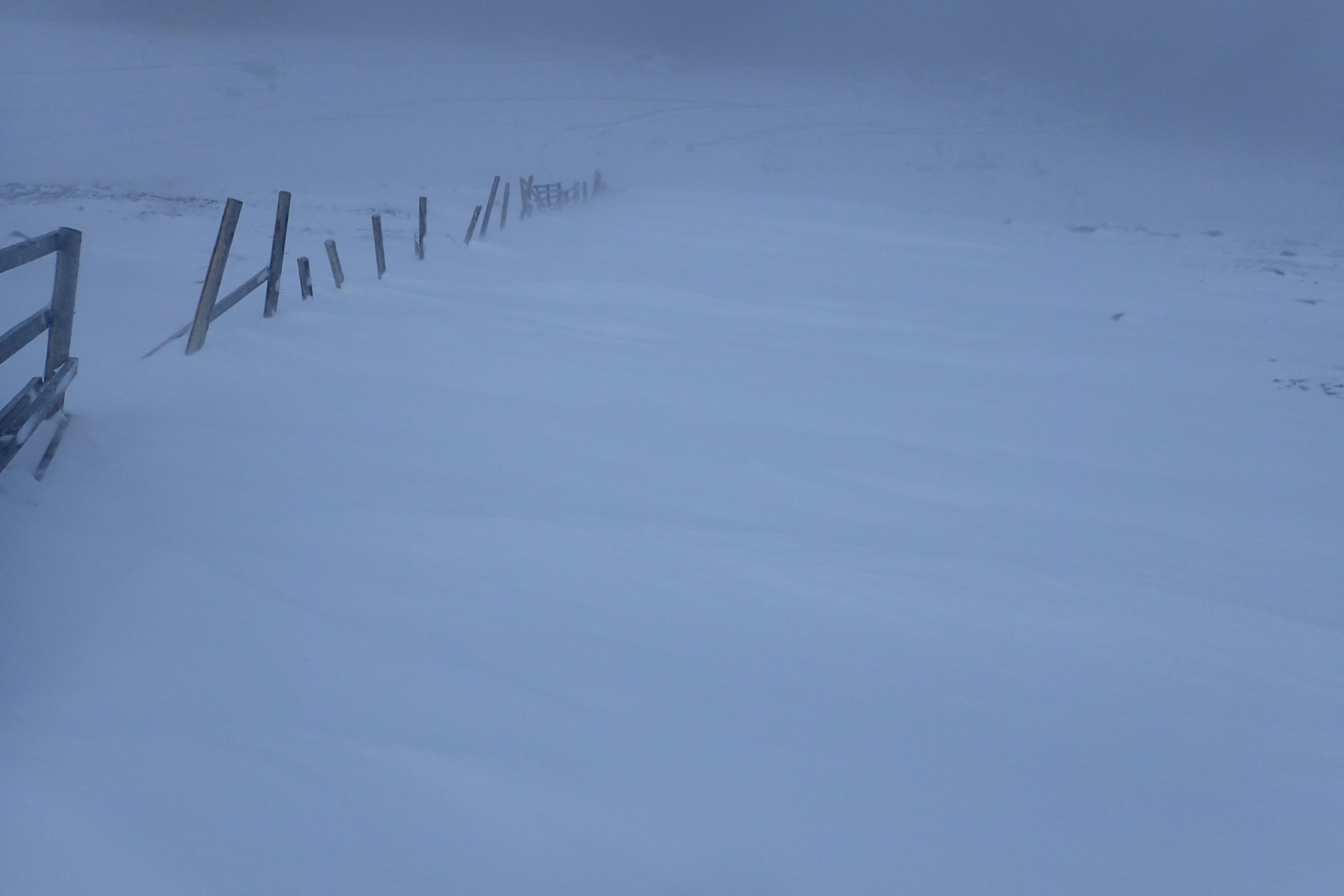
Drifting behind a rather dilapidated snow fence. There was not a great deal of snow here yesterday.
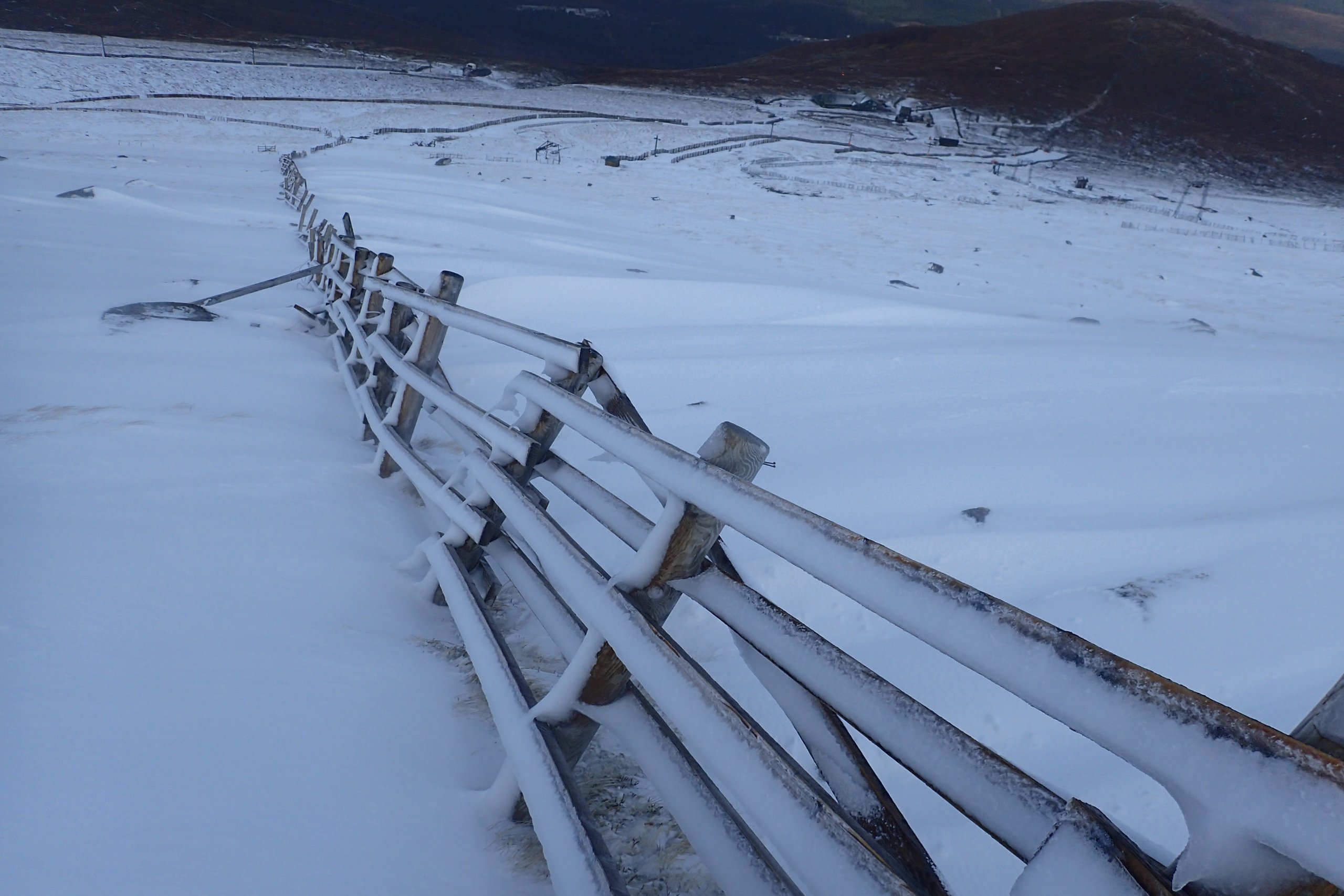
Iced-up snow fence. The same fence as in yesterday’s blog (although slightly higher up the hill side). I put this in to show how much snowier it as at this level (about 900m) than it was yesterday.
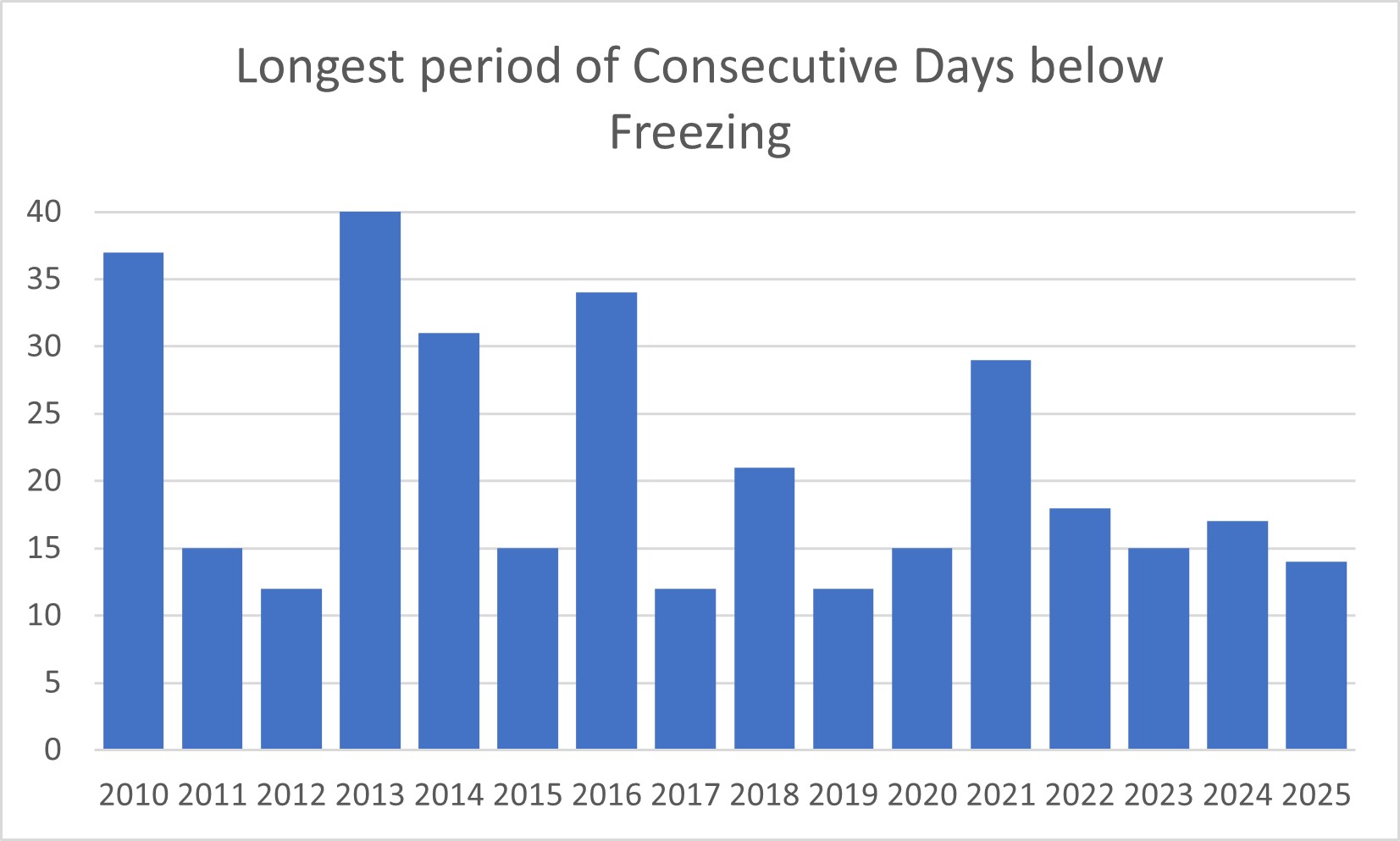
The longest spell of consecutive days when the midday summit temperature has been below freezing.
As discussed in previous blog posts, since the new year the winter has been dominated by cool dry spells separated by mild and often wet periods. So far there has been three cool periods when the midday summit temperatures have been below freezing. These were;
- 12 days from the 1st to the 12th of January inclusive,
- 12 days from the 18th to the 29th of January inclusive,
- 14 days from the 4th to the 17th of February inclusive
I decided to see how this compared with previous seasons. The graph above shows the greatest number of consecutive days that the Aonach Mor midday temperature was recorded as being below freezing that season.
The longest period was 40 days from the 3rd of March to the 11th of April 2013. Interesting that this spell was so late in the year, and perhaps gives a bit of hope for this season. The second longest period below freezing was 37 days. This actually occurred twice, first time was the 28th of January to the 5th of March 2010, and the second time between the 10th of January to the 15th of February that 2013. A cold winter 2013, given it have both the longest and joint second longest periods of subzero summit midday temperatures.
Since about 2016 there has been a decrease in the length of these subzero periods. Since then the longest period has been 29 days from the 17th of January to the 14th of February. Interestingly the joint second longest period of sub zero midday temperatures since 2016 also occurred in the 2020/21 season from the 20th of December to the 9th of January.
What to make of this, and if it tells us anything about future winters I am not sure. I suspect that is one for someone’s PhD rather than a blog post.
Comments on this post
Got something to say? Leave a comment


Mark Figiel
25th February 2025 6:34 pm
Interestingly 2015 has one of the lowest figures yet had one of the snowiest winters ever. If my memory serves me correct hundreds of snow patches survived until survey day in August and i remember a small snow patch surviving until November on the Bidean nam Bian. Will that ever happen again i doubt it.
i do remember the winter temperature was always around 6 degrees in central Scotland and weather fronts from the West fell as snow above 3000 feet week after week.
My own view is that we do not get the same number of weather fronts coming in from the West or North West since then and when they come from the South West do not always get as far North as Lochaber.
lochaberadmin
26th February 2025 12:59 pm
Yeah 2015 was a good year for snow patches, I think it was the only year since the mid nineties that snow survived through the year outwith the Cairngorms and the Lochaber hills (on Creag Meagaidh). A combination of a snowy winter and a cold spring, grade V ice routes were climbed on the Ben as late as the 18th of May that year. I think there may be something in the idea that the weather comes less from the West this winter, and the wet weather has been due to warm air being drawn up from the South or South-South-West.