Overnight Avalanches.
22nd January 2024
Last night the met office weather station on Aonach Mor recorded a gust of 115 mph. However, the weather station is not on the summit or even really on the summit plateau, and I wonder if in some directions it is not exposed to the full strength of wind. The WinterHighland AWS at the top of the White Coires ski area over in Glen Coe recorded a gust of 168mph at around 8:45 pm last night (see the first graph below, from https://www.winterhighland.info/weather/aws.php?wxstn=COESMT&time=48&wxvar=wind ). I am not sure how accurate this windspeed is, but it was certainly a very windy night.
Although the wind speeds were quite interesting, it was more the temperature and precipitation that drove the evolution of the snowpack. The second graph shows the temperature on the summit Aonach Mor from the Holfuy weather station (https://holfuy.com/en/weather/1365). It can be seen that yesterday afternoon the temperature rose above freezing reaching a peak of about +3.2C around 6:30pm. Over the next few hours there were some interesting rapid drops in the temperature, I am not sure what caused the. During the evening it also rained heavily. This change created a period of instability in the snowpack, the evidence of which was clear to see on Ben Nevis today. There had been large avalanches out of both Number 2 Gully area and Observatory Gully as well as some smaller (but still substantial) avalanches. This included another one on the West Face of Carn Mor Dearg. As I was said on the blog yesterday I had not seen an avalanche on this face before, and now I have seen two in a few days!
With the arrival of cold weather in the early hours, the snowpack froze (with all the water above the ice will be building rapidly at higher levels). However, snow showers started to build up the windslab, and will continue doing so until early tomorrow when the freezing level is again expected to rise above the summits and for heavy rain to fall. This will produce another period of instability, although in this case I am not expecting such a large avalanche cycle as last night due to the smaller amount of windslab which will be present. Will be interesting to see what happens.

Wind data from the AWS just across the way in Glen Coe. A gust of 168mph was recorded. I am not sure how accurate this record it, but I am sure it was gusting well over 100mph on many of the summits.

The temperature on the summit of Aonach Mor overnight and through the day. In summary mild until just after midnight, cool after that. Some unusual rapid drops in temperature at 19:00, 21:30 and 00:30. Not sure what would have caused these.

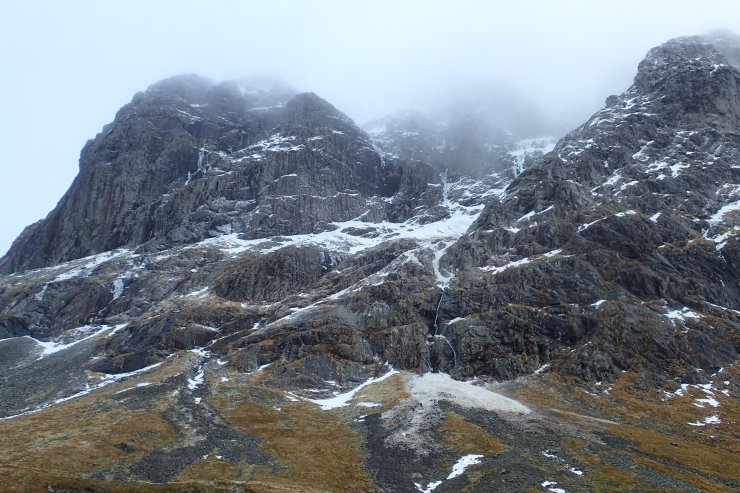
Looking up to Carn Dearg Buttress. Fresh debris centre right of the photo near the bottom. This would have come down one of the Castle Gullies.

More debris from the Observatory Gully avalanche. Over the season you tend to get quite a lot of avalanche activity in Observatory Gully. However, this is the biggest slide I have seen here for a few years.

Looking back to Observatory Gully, with the rough extend of the debris highlighted in red. Although you get a lot of avalanches in Observatory Gully most don’t make it past the narrow point in the gully visible in this picture above the debris field.

Looks like ice forming in the Zero Gully area. It is this kind of stormy weather which builds the ice and improves conditions on the higher crags.
Comments on this post
Got something to say? Leave a comment


