A Dry Winter in the West.
6th March 2021

Icicles forming on some old snow. Water courses are freezing creating strips of ice down otherwise dry ground.

Looking up at Ben Nevis. Thing tends to be pretty firm at the moment; dry rock, a refrozen icy snow, a few streaks of water ice and dry frozen ground.
Old avalanche debris in Observatory Gully. By the end of the winter the base of Observaory Gully is usually choked full of old avalanche debris, and this year is no exception.Â

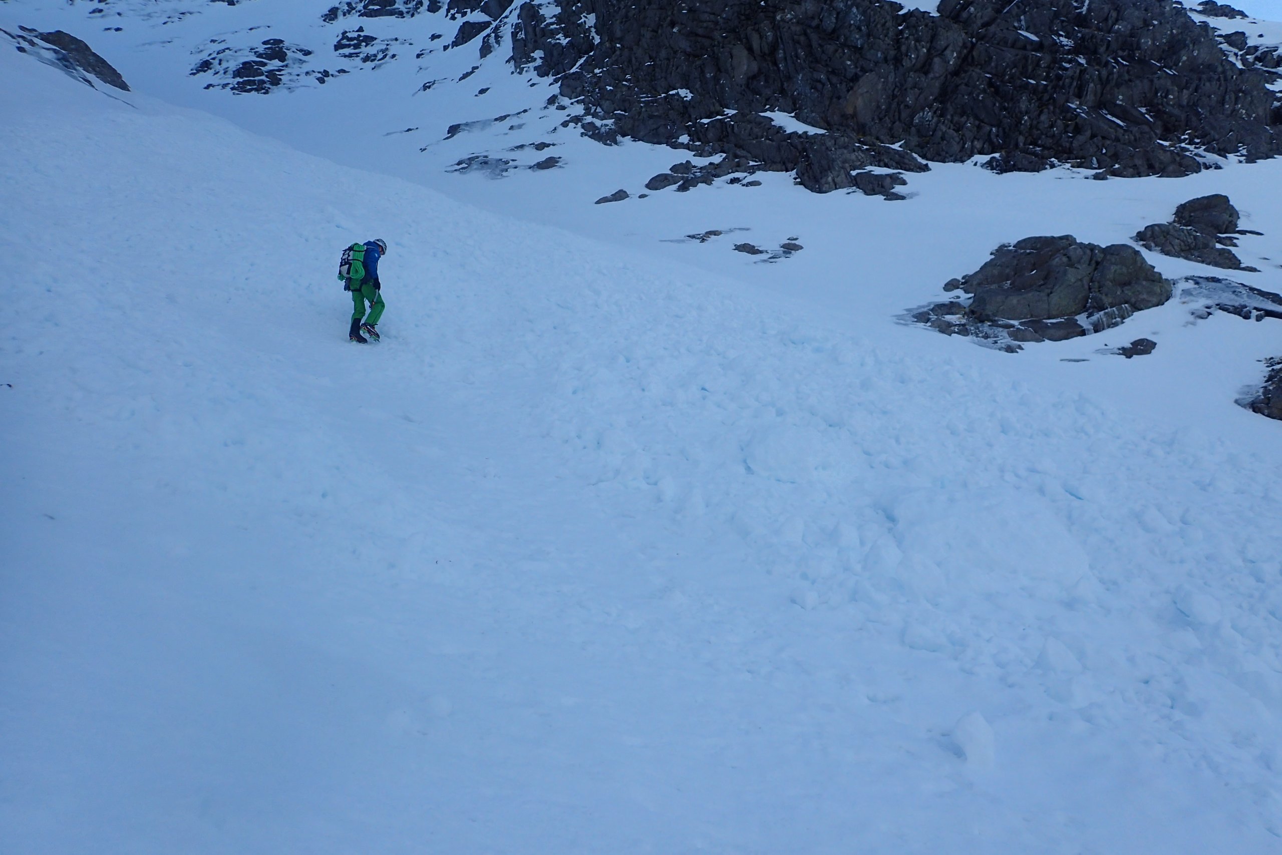
Looking up Observatory Gully today. Some years (such as 2020) patches of snow survive throughout the summer at the top of the gully to be incorporated into the following winter’s snowpack. Some of the snow in the bed of the gully would have fallen during November 2019. In terms of the quantity of snow in the gully at the moment; there is more than in March 2019, but not as much there was on the 21st March 2020. However, with cool unsettled weather forecast next week things might well improve yet.

This photo, from slightly higher up the hillside, was taken on 21st of March 2020, just before the lockdown began. As well as a more general snow cover, there was also a greater depth of snow in Observatory gully. This was partly due to February 2020 being unusually wet and being dominated by South Westerly winds which piles snow into the likes like of Observatory Gully. This year, by contrast, has be relatively dry in Lochaber, and the winds have been much more variable in direction (and at some point I will try and do some charts to illustrate this) which have at times scoured rather than loaded Observatory Gully.
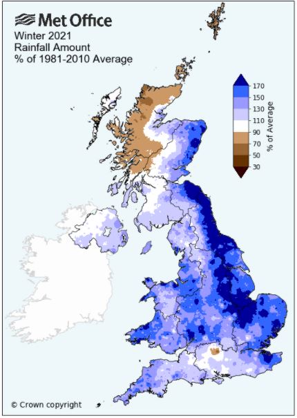 The met office rainfall anomaly map for this meteorological winter (1st Dec to 28th Feb). Most of the UK had a wetter than average winter. The exception to that is North and West Highlands (as well as some of the islands) which were in the rainshadow during the periods of Southerly and Easterly winds. Â
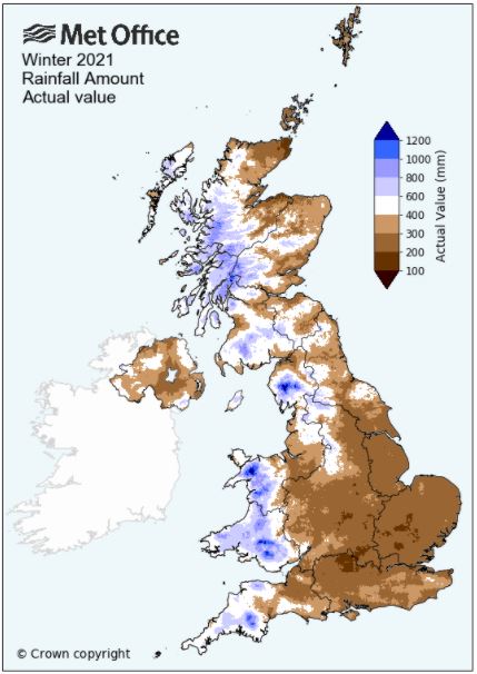
However, if you look at the actual rainfall map of the winter, the hills in the West of the UK stand out as being wetter than the rest of the country. The fact that the West Highlands had (other than a few small areas in the Lakes and Wales) more actual rainfall during the winter, and yet were also one of the few areas that had a negative rainfall anomaly, shows you quite how wet the area tends to be during the winter. This wetness has its advantages, but it also has disadvantages!
Comments on this post
Got something to say? Leave a comment


